
In the wake of an historic winter storm and Arctic blast that moved across the central and southern U.S. this week, the NOAA-20 satellite caught the resulting power outages across southeastern Texas.
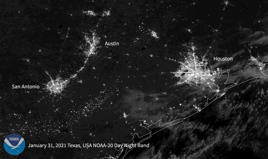
In this Day/Night Band imagery, the satellite’s VIIRS instrument shows the difference in nighttime illumination of city lights from before the storm, January 31, 2021, and after, February 16, 2021. Noticeable dimming can be seen around much of metropolitan Houston—indicative of power outages—as well as in portions of San Antonio and Austin.
The storm brought frigid temperatures, some of the lowest in decades, which crippled electric grids and left millions without power in several states. At least 23 people died across four states , with icy roads creating treacherous conditions. Texas was hit particularly hard, where grid failures were the most severe. In response, rolling power outages are currently being employed across the state to conserve electricity, and emergency managers are asking residents to conserve power when possible as well as to avoid traveling.
The NOAA-20 satellite and Suomi-NPP satellite are part of the Joint Polar Satellite System (JPSS). JPSS is the Nation’s advanced series of polar-orbiting environmental satellites. JPSS represents significant technological and scientific advancements in observations used for severe weather prediction and environmental monitoring. These data are critical to the timeliness and accuracy of forecasts three to seven days in advance of a severe weather event. JPSS is a collaborative effort between NOAA and NASA.