
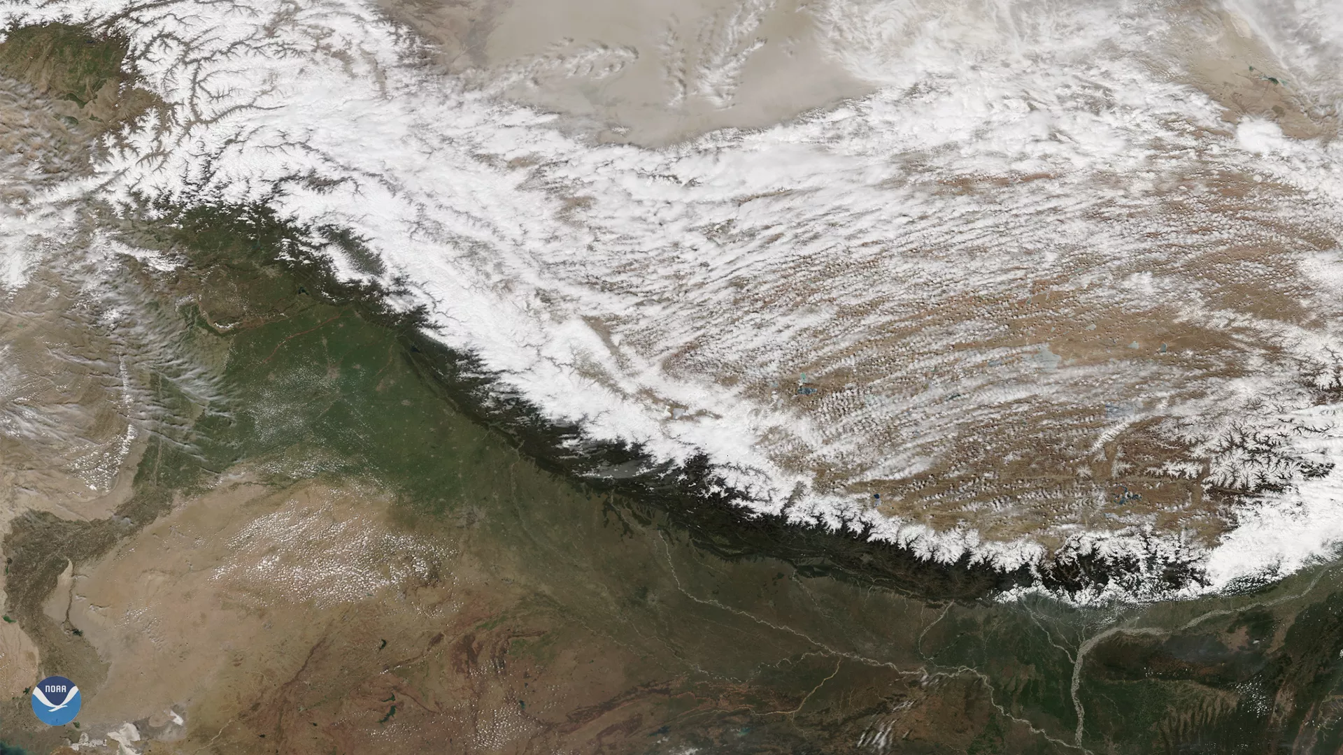
On March 29, 2020, the NOAA-20 satellite viewed the snowpack on top of the Hindu Kush Himalayas. During this time of the year, when the snow is melting, people of the Himalayan region replenish their freshwater stores from the mountain range’s runoff to prepare for the dry season.
The Hindu Kush Himalayan region is the location of several of Asia’s great river systems and its snowmelt provides water for drinking, irrigation, and other uses for about 1.5 billion people.Along with snowpack, the Himalayan peaks are home to glaciers--mountain glaciers, to be specific. Not just found in the Arctic, mountain glaciers develop in high mountainous regions, often flowing out of icefields that span several peaks or even a mountain range. Some of the largest mountain glaciers in the world are found in the South American Andes and Asian Himalayas, but their existence is tenuous.
Experts associated with the 2019’s Hindu Kush Himalaya Assessment estimate that the glaciers associated with the world’s tallest mountain range will shrink by as much as 33% by the end of this century. In the meantime, the VIIRS instrument on NOAA-20 and SNPP will continue to provide climate scientists with the latest information about the fluctuating snowpack levels and its changing reflectivity.
The NOAA-20 satellite, launched in 2017, scans the entire Earth twice per day at a 750-meter resolution. Multiple visible and infrared channels allow it to detect atmospheric aerosols, such as dust, smoke and haze associated with industrial pollution and fires. The polar-orbiting satellite circles the globe 14 times daily and captures a complete daytime view of our planet once every 24 hours.