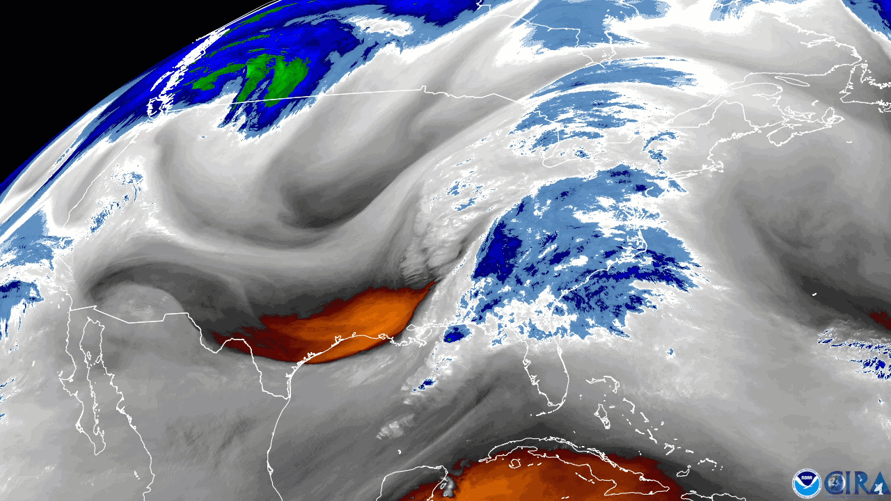
NOAA’s GOES East satellite captured a strong storm system that pushed through along the eastern United States, using the satellite’s upper-level water vapor channel (band 8). This imagery from November 30-December 1 shows how far south the system dove into the U.S., with dry air (orange shading) wrapping into the system as it swirled up the East Coast.
According to the National Weather Service , “the storm system across the east has a powerful wind field moving warm air northward ahead of it and cold air southward behind it.” As a result, Bangor, Maine reported a temperature of 58 degrees on the morning of December 1; the same temperature Tampa, Florida reported that same morning, more than 1,500 miles away. Both places saw strong winds as well, with wind gusts of 58 mph and 41 mph , respectively. Additionally, heavy snow fell across the Great Lakes, Appalachians, and even as far south as Tennessee.
Additionally, an EF-0 tornado was reported in Montgomeryville, Pa., around 9 p.m. EST. The state of Pennsylvania recorded numerous downed trees due to high winds sweeping throughout the area. Felled trees were also reported in Delaware, New Jersey, and Maryland.
The GOES East geostationary satellite, also known as GOES-16, keeps watch over most of North America, including the continental United States and Mexico, as well as Central and South America, the Caribbean, and the Atlantic Ocean to the west coast of Africa. The satellite's high-resolution imagery provides optimal viewing of severe weather events, including thunderstorms, tropical storms, and hurricanes.