

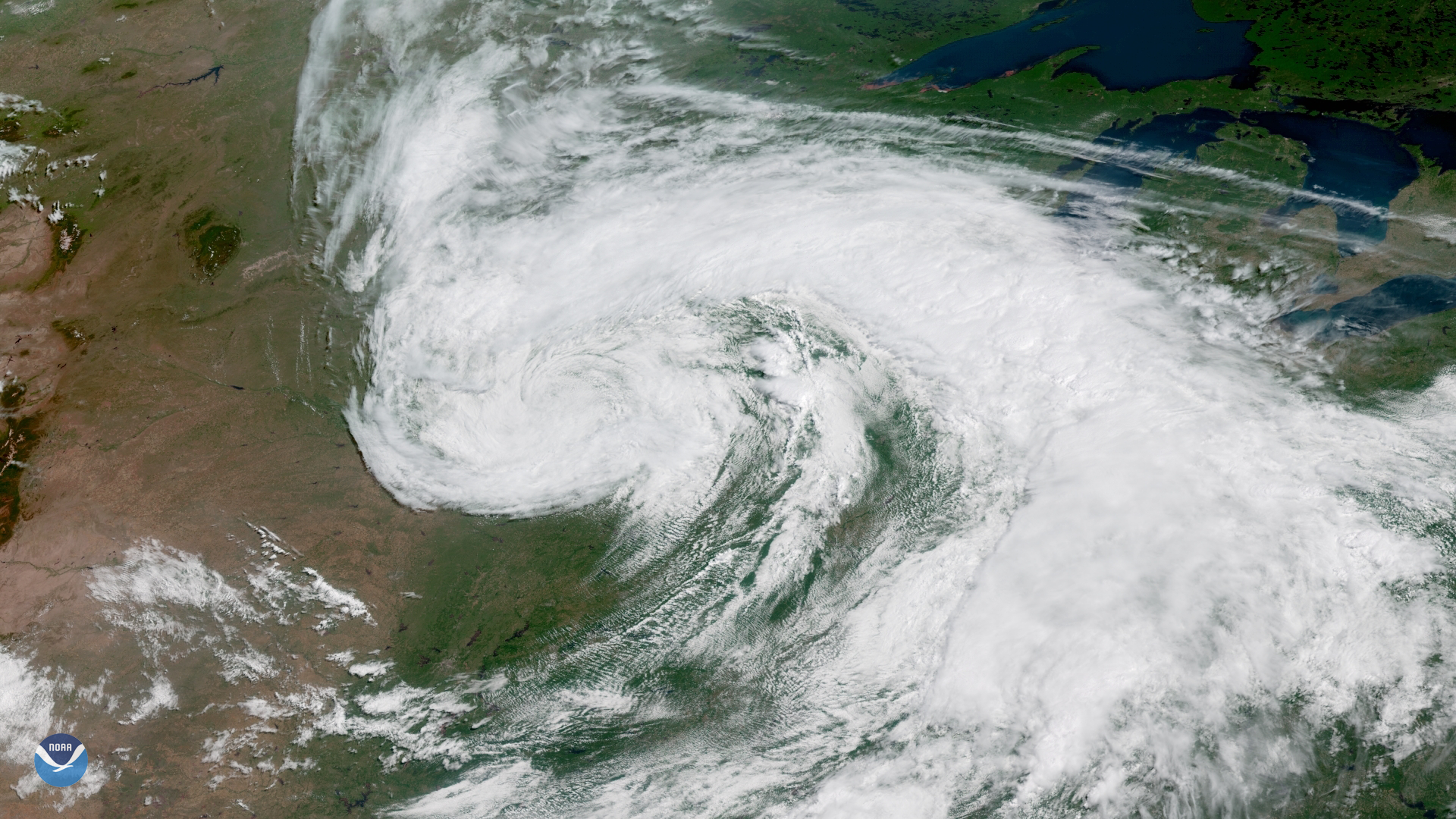
On the first day of astronomical summer , the GOES East satellite captured this image of a large storm system moving across the central United States. The comma-shaped cloud pattern and well-defined circulation indicate that this was a mid-latitude cyclone, a type of storm we more commonly see during the colder months of the year.
A mid-latitude cyclone is a synoptic (large-scale) low pressure system that forms along weather fronts in Earth's mid-latitudes (usually between 30° and 60° latitude from the equator). In the continental U.S., these storms most often occur from late fall to early spring when the temperature contrast between warm and cold air masses is greatest. During winter, strong low pressure systems can produce a wide variety of weather impacts, including heavy snow, sleet, rain, and coastal flooding.
As temperatures warm and summer arrives, mid-latitude cyclones become much less common over the continental U.S. By late June, the temperature contrast between warm and cold air masses is smaller, and the jet stream, the fast-moving wind current high in Earth's atmosphere along which these storms form, retreats northward into Canada. Occasionally, however, a mid-latitude cyclone will form along a strong frontal boundary during the warmest months of the year. The storm shown here brought heavy precipitation to the Midwest, with 24-hour rainfall totals exceeding 4 inches along the border of Minnesota, Iowa and South Dakota.
This geocolor enhanced imagery was created by NOAA's partners at the Cooperative Institute for Research in the Atmosphere. The GOES East geostationary satellite, also known as GOES-16, provides coverage of the Western Hemisphere, including the United States, the Atlantic Ocean and the Gulf of Mexico. The satellite's high-resolution imagery provides optimal viewing of high-impact and severe weather events, including hurricanes, tropical storms, and mid-latitude cyclones, as seen in this imagery.