
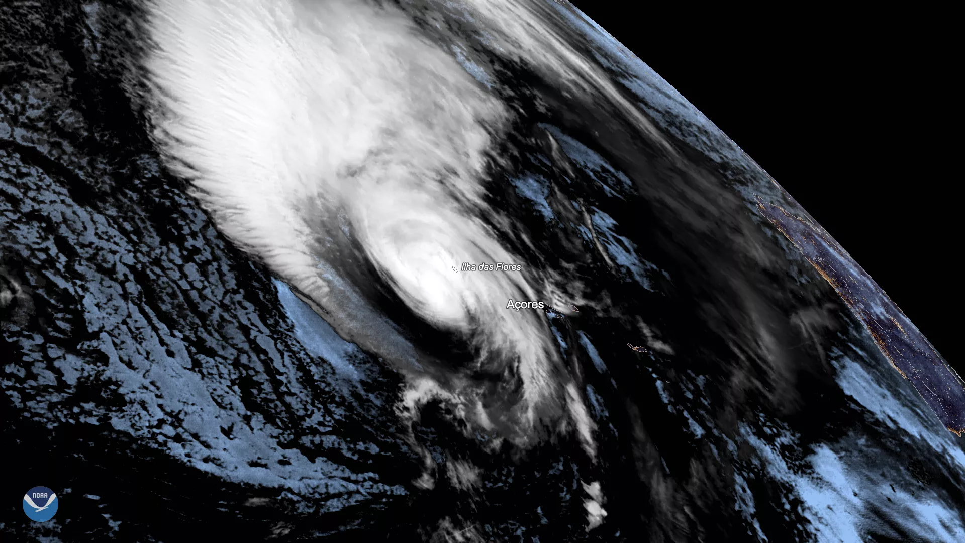
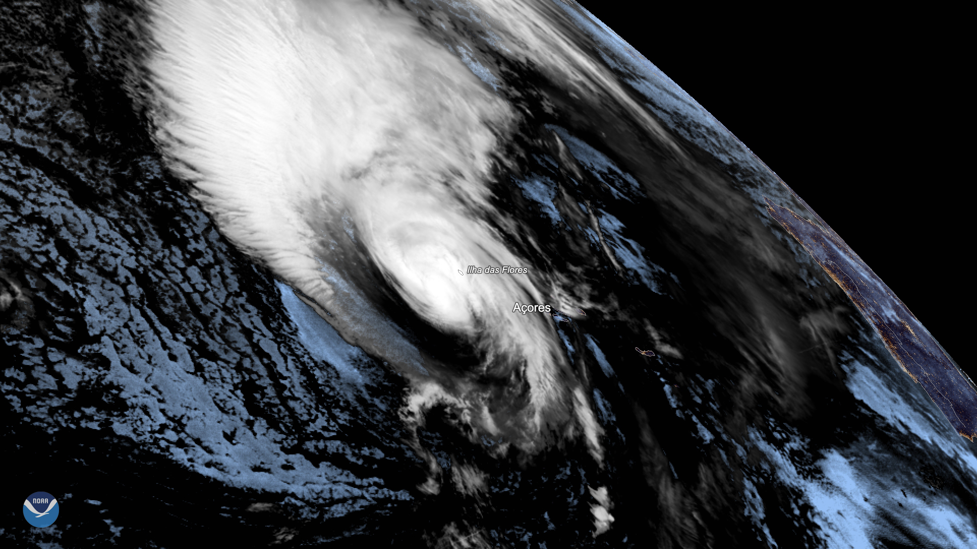
Hurricane Lorenzo lashed Portugal’s Azores Islands early Wednesday morning, toppling trees and downing power lines as the then-Category 2 storm passed by. NOAA’s GOES East satellite saw the storm as it battered the islands with heavy rain, powerful winds and high waves on Oct. 2, 2019.
Now a post-tropical cyclone, Lorenzo is expected to take aim at Ireland and some western parts of the United Kingdom later this week. The Irish Meteorological Service, Met Éireann , issued orange-level wind warnings for Galway, Mayo, Clare, Cork, Kerry and Limerick ahead of the storm’s arrival on Thursday morning. In those areas, Met Éireann says average wind speeds could reach 40-50 mph and be accompanied by up to 80 mph gusts. The remainder of Ireland, as well as parts of southwest England and south Wales, are under a yellow-level wind warning, which means average wind speeds are likely to stay around 30-40 mph.
As the storm moves through, Met Éireann warned that the main impacts from Lorenzo will likely include flooding and falling trees.
“In early October, trees are mostly in full leaf with a large surface area, so even moderate strength winds can bring down weakened trees and/or tree limbs,” Met Éireann noted.
This geocolor-enhanced imagery was created by NOAA's partners at the Cooperative Institute for Research in the Atmosphere. The GOES East geostationary satellite, also known as GOES-16, provides coverage of the Western Hemisphere, including the United States, the Atlantic Ocean and the eastern Pacific.