
April 29, 2020
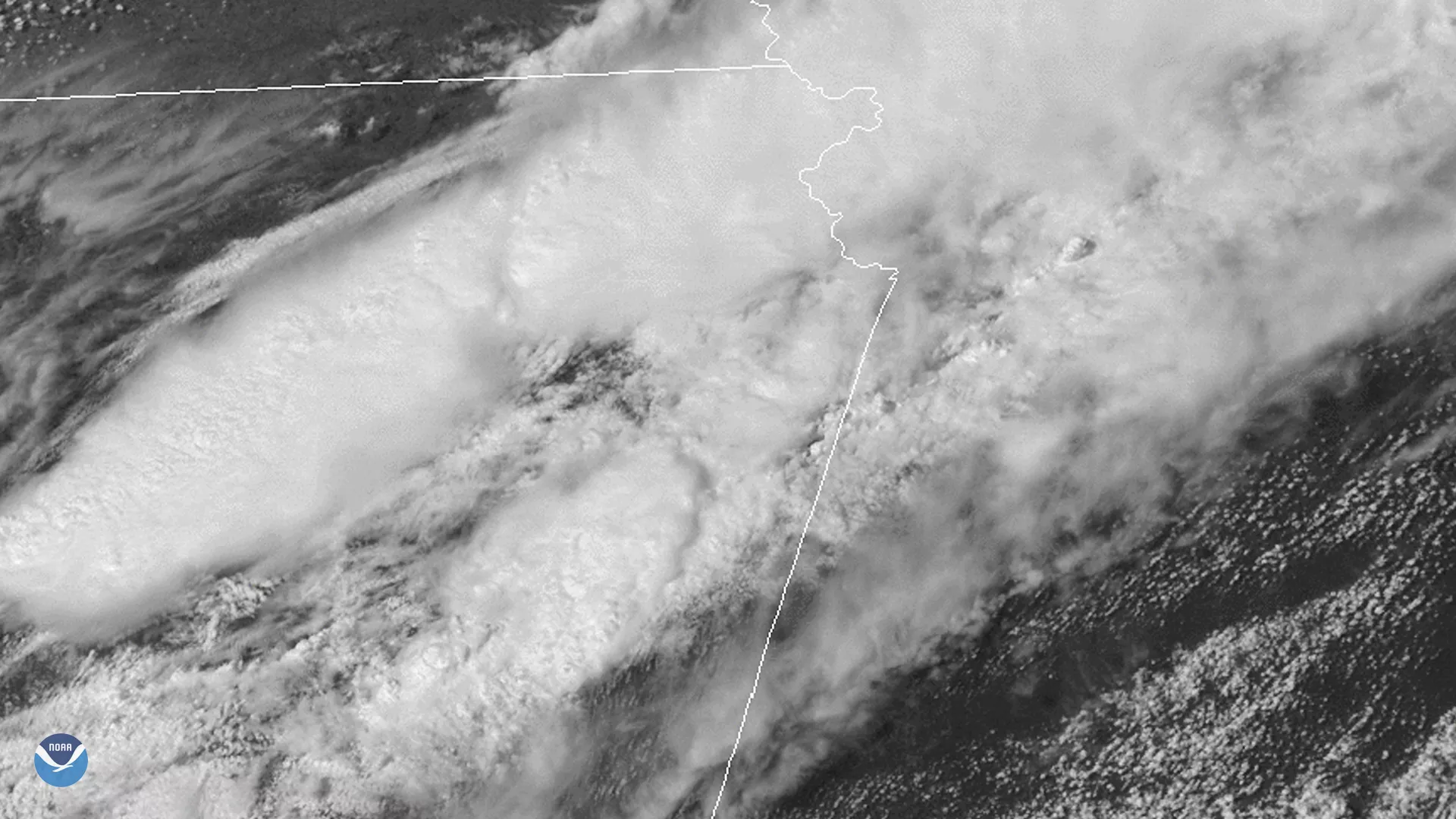
On the night of April 28, 2020, the GOES-East satellite, via Band 2 of the Advanced Baseline Imager (ABI), caught a billowing squall line rolling over the Great Plains. According to the National Severe Storms Laboratory’s (NSSL) page on thunderstorm types , “a squall line is a group of storms arranged in a line, often accompanied by “squalls” of high wind and heavy rain.” Squalls and related weather phenomena are usually only 10 to 20 miles wide and can be up to hundreds of miles wide; this particular event crossed state lines, stretching from Texas into northwestern Missouri.
Typically, fire weather is a high risk for this area during this time of year for parts of Kansas , due to warming temperatures and higher wind speeds combined with lower relative humidity. For northwestern Missouri, including Kansas City, a wind advisory is in effect until 7 p.m. CDT; wind speeds are anticipated to top 35 to 45 mph in a northwestern direction. Thunderstorms and occasional showers are likely to continue until the beginning of next week.
The GOES-East geostationary satellite, also known as GOES-16, keeps watch over most of North America, including the continental United States and Mexico, as well as Central and South America, the Caribbean, and the Atlantic Ocean to the west coast of Africa. The satellite's high-resolution imagery provides optimal viewing of severe weather events, including thunderstorms, tropical storms, and hurricanes.