
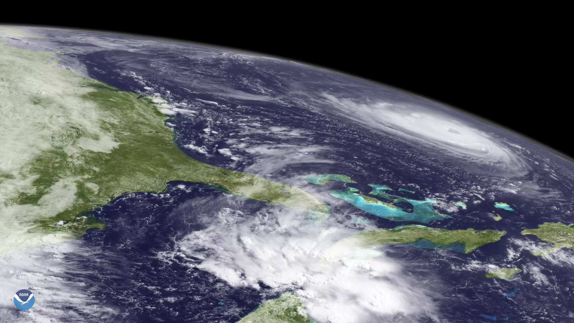
NOAA's GOES-15 satellite captured this limb view of Hurricane Florence churning through the western Atlantic Ocean at 10 a.m. ET on September 11, 2018. The latest update from the National Hurricane Center at the time showed Florence moving west-northwest around 17 mph, with its forward speed expected to increase over the next 24-48 hours. As of 2 p.m. ET Tuesday, Florence was still a dangerous Category 4 hurricane with sustained winds near 130 mph, and hurricane-force winds extending 60 mph from the center of its circulation.
Florence was expected to begin re-strengthening as it entered the warm waters of the Gulf Stream off the U.S. East Coast. While the storm might weaken as it approached the coast of the Carolinas, then-current forecasts suggested that Florence would still be an extremely dangerous storm at landfall. The National Hurricane Center warned of life-threatening storm surge for areas along the coast, and potentially catastrophic flooding as Florence stalled over the Southeast and Mid-Atlantic, where it was expected to dump extremely heavy rainfall over the region.
The GOES-15 satellite was NOAA's operational GOES West satellite from August 2011 through March 2020. GOES West provides geostationary coverage of the United States, western South America and much of the Pacific Ocean, from 22,300 miles above Earth. In this image, Florence appears at the northeast edge of the satellite's coverage area over the western Atlantic Ocean.