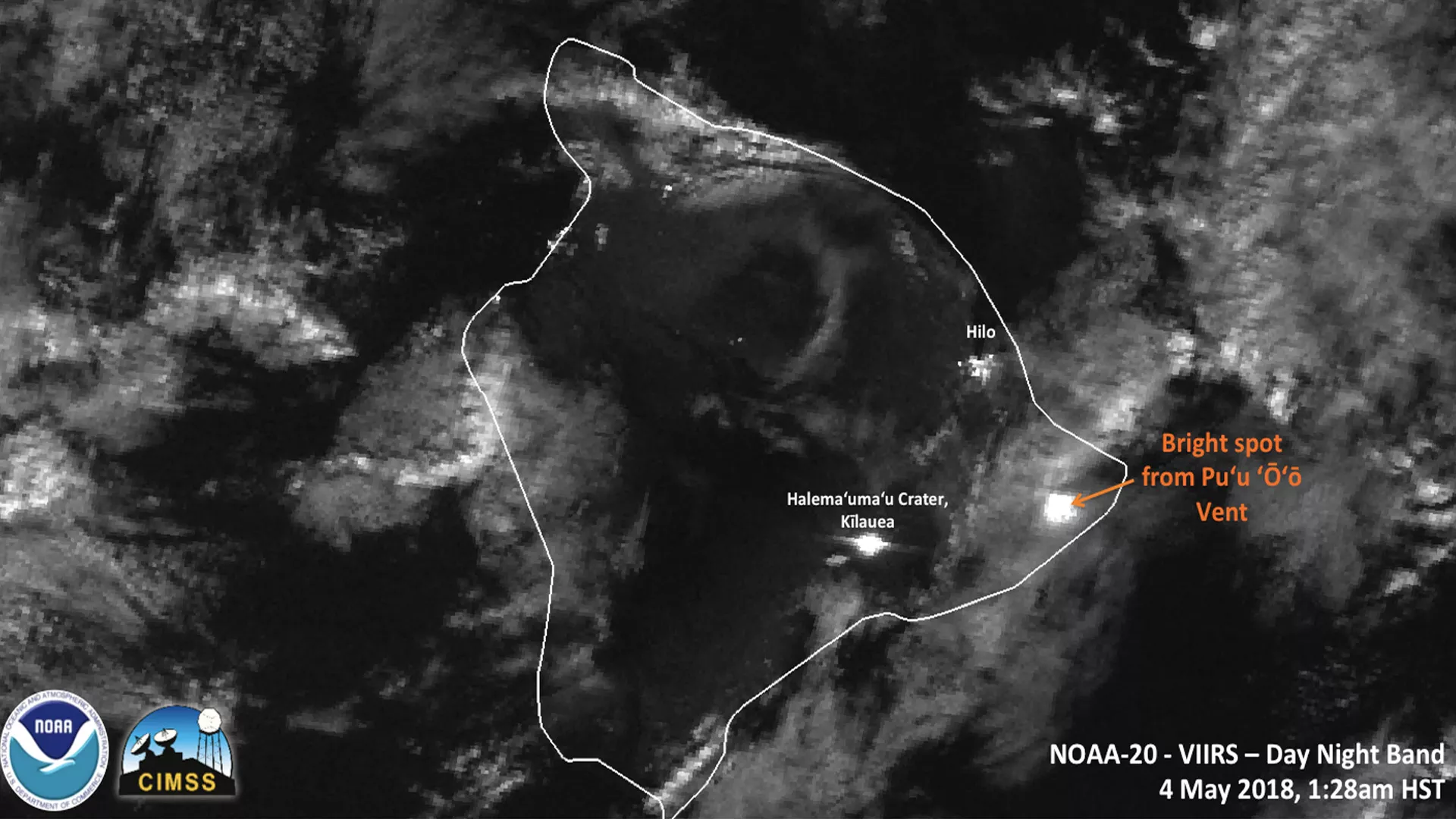
The NOAA-20 polar-orbiting satellite instrument captured Thursday's eruption of Hawaii's Kilauea volcano in this nighttime imagery seen by the satellite's VIIRS sensor. On May 3, the U.S. Geological Survey reported a strong earthquake on Hawaii's Big Island. The earthquake led to the collapse of Pu'u 'O'o crater on Kilauea, sending a large plume of volcanic ash into the sky and dangerous lava flows into nearby towns. More than 1,000 people have been forced to evacuate, according to media reports.
This imagery is from the day-night band on the NOAA-20 satellite's Visible Infrared Imaging Radiometer Suite, or VIIRS sensor, and can detect visible and emitted light at night. Even while obscured by clouds, the bright spot caused by the lava from Thursday's eruption can be seen in the eastern portion of Hawaii's Big Island.
Kilauea is one of Hawaii's most active volcanoes and has been actively erupting since 1983. The volcano is estimated to be between 300,000 and 600,000 years old.
Image credit: Cooperative Institute for Meteorological Satellite Studies (CIMSS).