

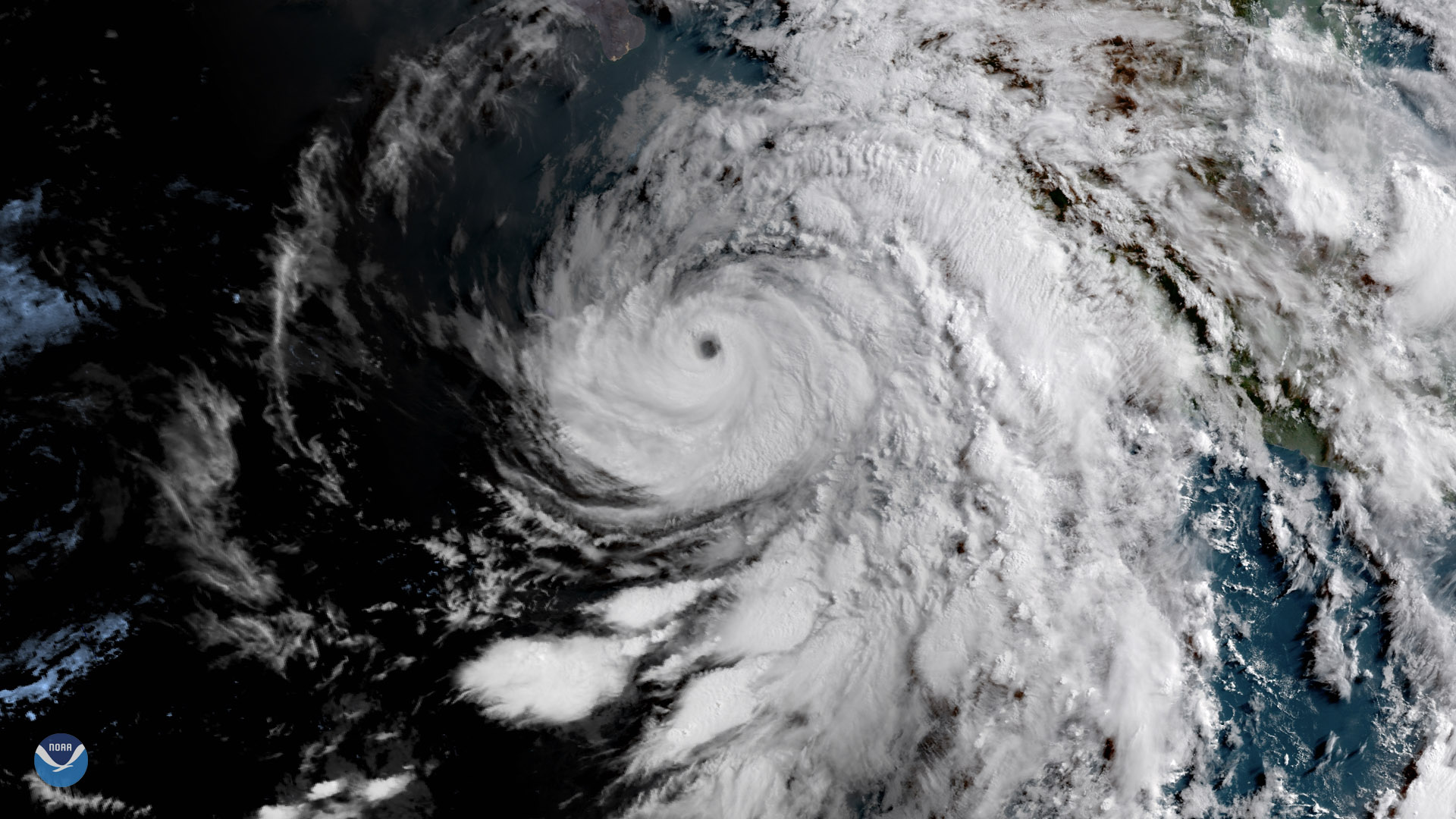
The GOES East satellite captured this image of the sun rising over Hurricane Bud in the eastern Pacific Ocean on June 12, 2018. Positioned roughly 200 miles off the western coast of Mexico, Bud is the second named storm of the 2018 Eastern Pacific hurricane season, and the second storm within four days to reach Category 4 strength - following the rapid intensification of Hurricane Aletta late last week. The latest update from the National Hurricane Center shows Bud's one-minute sustained winds were around 125 mph, after briefly reaching 130 mph as a weak Category 4 storm.
Bud is expected to weaken to a tropical storm as it tracks northward into cooler waters. Current forecasts show the storm bringing heavy rain to the Baja Peninsula as well as much-needed moisture to the Southwest U.S. later this week.
This geocolor enhanced imagery was created by NOAA's partners at the Cooperative Institute for Research in the Atmosphere. The GOES East geostationary satellite, also known as GOES-16, provides coverage of the Western Hemisphere, including the United States, the Atlantic Ocean and the eastern Pacific. The satellite's high-resolution imagery provides optimal viewing of severe weather events, including thunderstorms, tropical storms and hurricanes.