
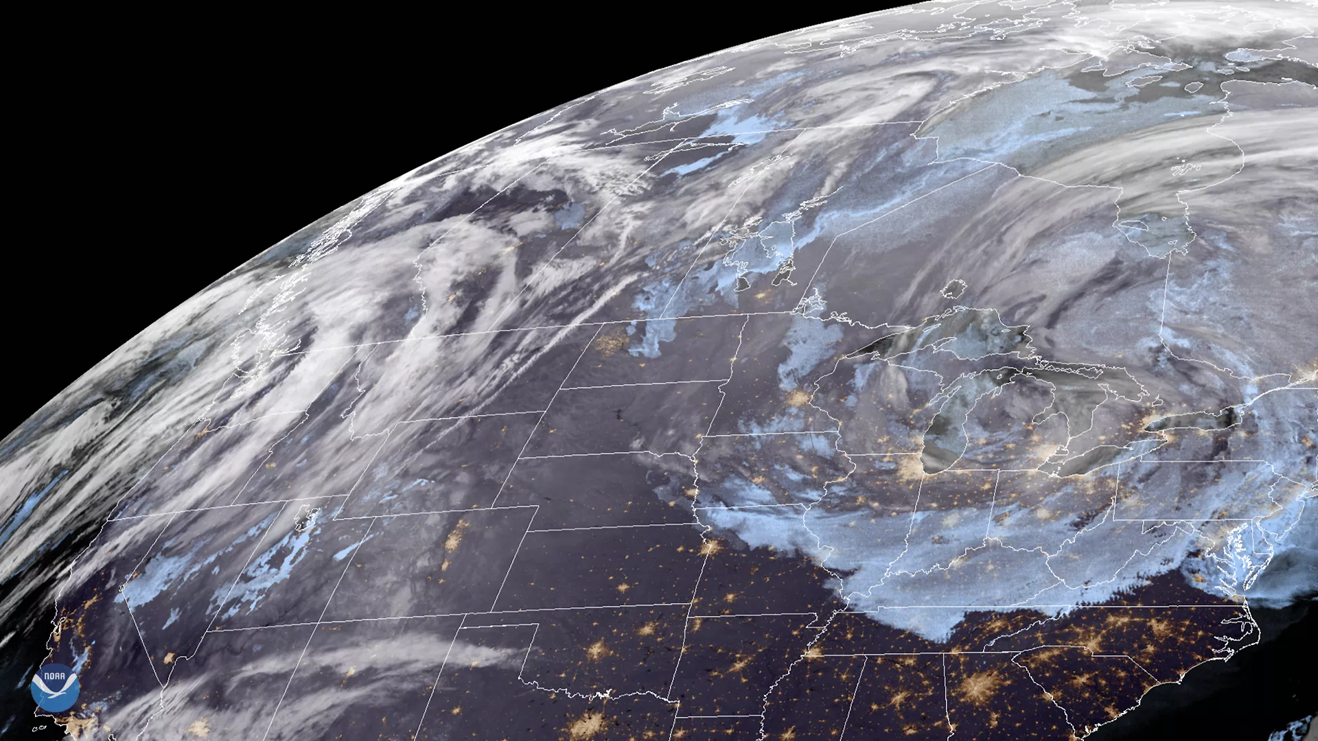
On Dec. 31, 2019, GOES East saw a gradual abatement of a lake enhanced major winter storm system that has affected the Great Lakes region of the U.S. for the past two days. This storm, according to NOAA’s National Weather Service (NWS), “will continue to bring snow, wind, and hazardous travel conditions early this week over the upper Midwest and Great Lakes regions.” Area residents are advised to exercise all due caution while doing routine activities.
Weather advisories from Sunday, Dec. 29 stated that the heaviest snow fell in Northern Wisconsin and the Upper Peninsula of Michigan. The Hazardous Weather Outlook for the region elaborates that “accumulations around one to three inches will fall by [Dec. 31] afternoon as an upper-level disturbance moves across the Great Lakes.” However, there is little probability for lasting accumulation for the most heavily populated Southeast Lake Michigan region, with much more settling around Lake Erie instead due to a low-pressure system coming into Ontario, Canada on New Year’s Eve. Fortunately, snow is expected to cease around Lake Michigan by early morning on New Year’s Day.
The GOES East geostationary satellite, also known as GOES-16, keeps watch over most of North America, including the continental United States and Mexico, as well as Central and South America, the Caribbean, and the Atlantic Ocean to the west coast of Africa. The satellite's high-resolution imagery provides optimal viewing of severe weather events, including thunderstorms, tropical storms, and hurricanes.