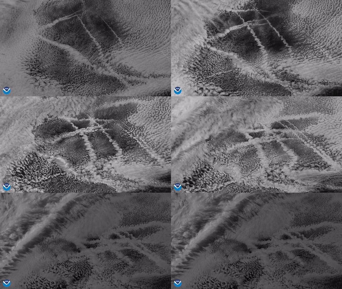
From its vantage point nearly 22,300 miles up, the GOES-West satellite captured this imagery of ship tracks embedded in stratocumulus clouds over the eastern Pacific from June 11–12, 2020 via red visible band 2 on its Advanced Baseline Imager (ABI). This band has the finest spatial resolution of all the ABI bands (0.5 km), which makes it ideal for detecting small cloud details and rapidly-changing atmospheric phenomena.
These crisscrossing ship tracks are formed when cargo ships travel across the ocean, and typically occur in areas where low-lying stratus and cumulus clouds are present. Tiny aerosol particles (especially sulfates) in their exhaust act as what meteorologists call cloud condensation nuclei or “seeds” around which moisture in the atmosphere can condense. When conditions are right, we are occasionally able to see these in cloud imagery.
Although ship track clouds are highly reflective and can produce a local cooling effect by shading Earth from incoming sunlight, it is difficult to determine whether these clouds have any wide-reaching global effects.
The GOES-West satellite, also known as GOES-17, provides geostationary satellite coverage of the Western Hemisphere, including the United States, the Pacific Ocean, Alaska, and Hawaii. First launched in March 2018, the satellite became fully operational in February 2019.
