
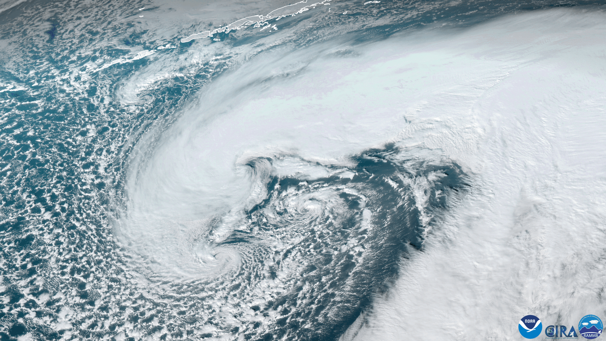
On Jan. 13, 2021, the GOES West satellite captured this stunning GeoColor imagery of a strengthening mid-latitude cyclone near the Aleutian Islands as it approached the Gulf of Alaska. This low pressure system reached a low of 961 mbar with wind speeds of 74 mph and wave heights in excess of 40 feet, according to the National Weather Service Ocean Prediction Center.
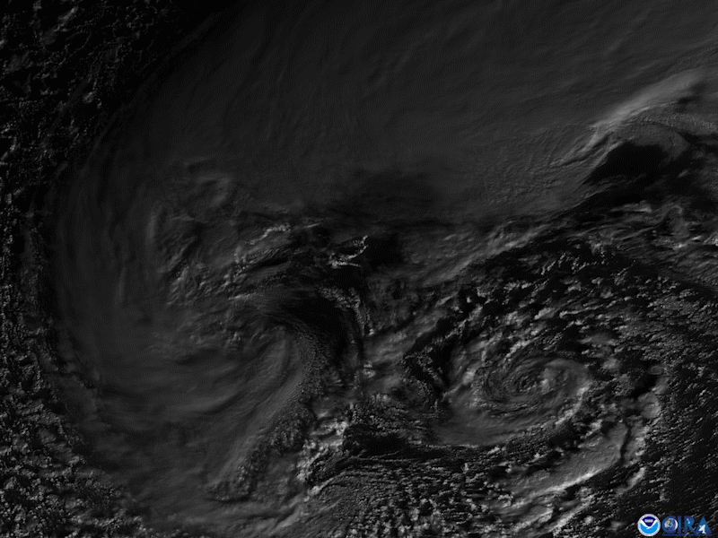
From this imagery, we can clearly discern an interesting feature: three swirling mesovortices within the larger system. We zoomed in for a better look via the satellite’s Red Visible band 2 (below), which has the finest spatial resolution of the Advanced Baseline Imager’s bands.
The above GeoColor enhanced imagery was created by NOAA's partners at the Cooperative Institute for Research in the Atmosphere. The GOES West satellite, also known as GOES-17, provides geostationary satellite coverage of the Western Hemisphere, including the United States, the Pacific Ocean, Alaska and Hawaii. First launched in March 2018, the satellite became fully operational in February 2019.