
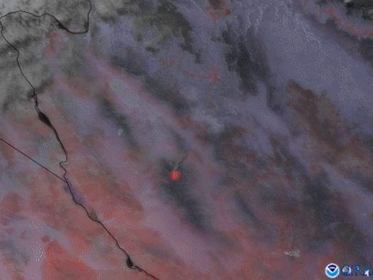
On April 25, 2021 the GOES West satellite focused in on the Flag Fire in western Arizona using a combination of the high-resolution visible channel on the satellite’s Advanced Baseline Imager, and Fire Temperature RGB , which shows hotspots based on temperature. Red areas indicate the “coolest” temperatures, with hotter-burning fires ranging from orange to yellow to white.
The Flag Fire was first reported that same day, Sunday, April 25, originating between the Flag Mine and Wild Cow Campground in Hualapai Mountains, approximately 11 miles south/southeast of Kingman, Arizona. As of Monday evening, the fire covered roughly 1,400 acres and crews are working to contain it. Luckily the area is expected to see showers and thunderstorms, which will likely help their efforts.
The GOES West satellite, also known as GOES-17, provides geostationary satellite coverage of the Western Hemisphere, including the United States, the Pacific Ocean, Alaska and Hawaii. First launched in March 2018, the satellite became fully operational in February 2019.