
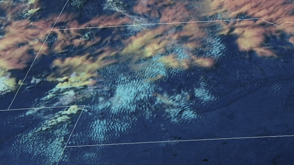
From the evening of May 3 into the early morning of May 4, 2020, the GOES-East satellite used a combination of its visible band and Day Cloud Phase Distinction RGB to watch a line of supercell thunderstorms develop over Nebraska.
These storms have formed ahead of a low pressure system coming out of the Plains, which is pushing eastward today into the Ozarks and mid-Mississippi Valley. The storms are expected to bring damaging winds, hail, and heavy rain, though localized tornadoes are possible as well.
Day Cloud Phase Distinction RGB is used to monitor the development of storms, since it helps evaluate the temperature of cloud tops via reflectance differences between the visible and near infrared channels, as well as show temperature variances between land and clouds. It can also be used to identify snow on the ground.
The GOES-East geostationary satellite, also known as GOES-16, keeps watch over most of North America, including the continental United States and Mexico, as well as Central and South America, the Caribbean, and the Atlantic Ocean to the west coast of Africa. The satellite's high-resolution imagery provides optimal viewing of severe weather events, including thunderstorms, tropical storms, and hurricanes.