
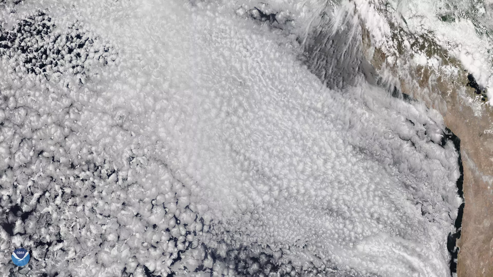
The NOAA-20 satellite snapped this beautiful photo of marine stratocumulus clouds (MSCs) off the western coast of South America on Dec. 3, 2019. These typically lie at low-altitudes below 6,000 feet, covering about 20 percent of the low-latitude oceans, or 6.5 percent of the Earth’s surface.
MSCs typically form over water and have either closed- or open-cell forms — the difference has to do with their cloud cover. Closed-cell MSCs cover nearly 100 percent of the underlying Earth’s surface and reflect a large portion of solar radiation. Open-cell MSCs, on the other hand, have broken cloud structures that surround areas of clear sky, which do not block much solar radiation.
The image above contains both forms of these clouds. Can you tell which ones are which?
Interestingly, changes in the local air quality have been found to affect these clouds. In fact, a study published in the Journal of Geophysical Research found that emissions, such as those from ships, can cause the transition from open- to closed-cell MSCs over large areas. Additionally, another study from JGR Atmospheres found that dust, smoke, pollutants, and other aerosols from continents can cause the same effect.
This image was captured by the NOAA-20 satellite's VIIRS instrument , which scans the entire Earth twice per day at a 750-meter resolution. Multiple visible and infrared channels allow it to detect atmospheric aerosols, such as dust, smoke and haze associated with industrial pollution and fires. The polar-orbiting satellite circles the globe 14 times daily and captures a complete daytime view of our planet once every 24 hours.