

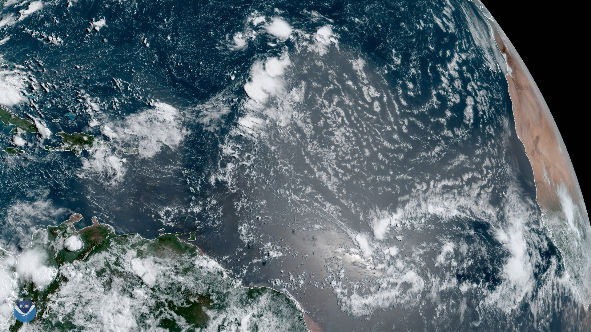
GOES East is ideally located to detect Saharan dust blowing across the Atlantic Ocean, as shown in this GeoColor image on August 1, 2019. The presence of a strong Saharan Air Layer (SAL), a dry and sometimes dust-laden layer of the troposphere that often stabilizes the environment around tropical systems as it traverses across the Atlantic Ocean basin, has been shown to influence Atlantic hurricane activity. Most of the properties associated with the SAL deter hurricane development. Therefore, characterizing this air mass in extent and strength is an important component in hurricane forecasting.
This GeoColor enhanced imagery was created by NOAA's partners at the Cooperative Institute for Research in the Atmosphere. GeoColor imagery is created by combining multiple channels from the satellite’s Advanced Baseline Imager (ABI) to simulate how meteorological and atmospheric features would appear to the human eye.
The GOES East geostationary satellite, also known as GOES-16, keeps watch over most of North America, including the continental United States and Mexico, as well as Central and South America, the Caribbean, and the Atlantic Ocean to the west coast of Africa. The satellite's high-resolution imagery provides optimal viewing of severe weather events, including thunderstorms, tropical storms, and hurricanes.