
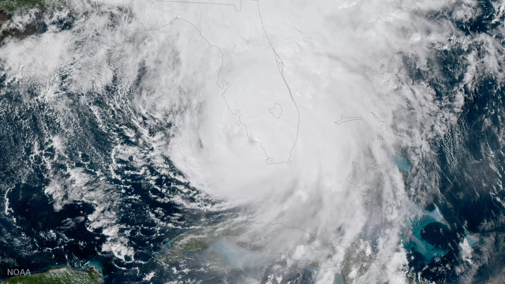
NOAA's GOES-16 captured this geocolor image of Hurricane Irma making a second landfall near Marco Island, Florida, in the afternoon of September 10, 2017. After making landfall at Cudjoe Key at 9:10 am EDT, Irma made a second landfall on Marco Island at 3:35 p.m. A wind gust of 130 mph was reported by the Marco Island police, according to the National Weather Service. Now a tropical storm, Irma is expected to move into southwestern Georgia later today, and move into eastern Alabama Tuesday (9/12) morning. Irma's maximum sustained winds have decreased to near 65 miles per hour with higher gusts. Continued slow weakening is forecast, and Irma is likely to become a tropical depression on Tuesday.