
GOES-13 has served in the GOES East position since April 2010.
Ten years ago today, on May 24, 2006, GOES-13 was launched into orbit aboard a Boeing Delta IV rocket that took flight from Cape Canaveral, Florida.
NOAA’s GOES spacecraft operate as a two-satellite system in geosynchronous orbit above the equator. Orbiting at speeds equal to Earth’s rotation, together they provide constant monitoring of the entire Western Hemisphere.
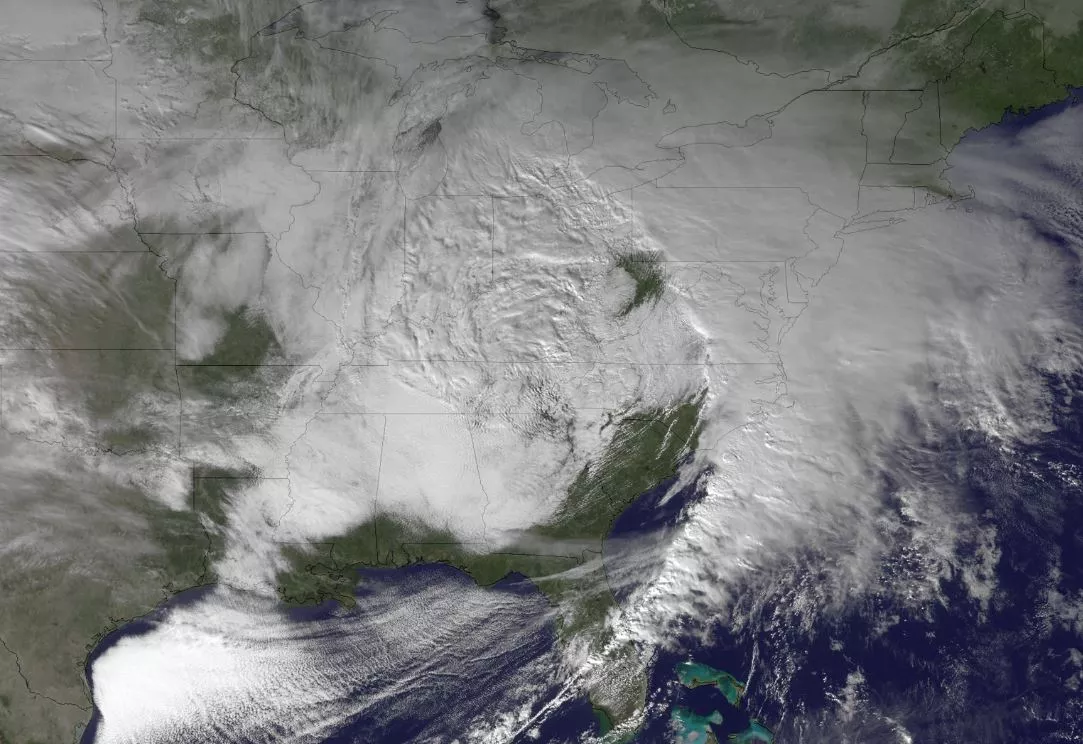
GOES East (aka: GOES-13) captured images of the strong storm system that brought hazardous winter weather to the central and southern U.S. on Christmas 2012.
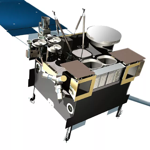
Known as GOES-N prior to launch, GOES-13 has been serving actively as GOES East since April 2010 and features a variety of enhanced instruments whose capabilities surpass those of earlier GOES satellites. Among them are:
- An improved Image Navigation and Registration (INR) system that uses star trackers, optical devices that measures the position of the stars to help with spacecraft orientation, to provide more stable and accurate Earth-pointing capabilities, decreasing the amount of “shake” in an image.
- An imaging radiometer that uses data obtained from its five channels to continuously produce images of the Earth’s surface, oceans, severe storm development, cloud cover, cloud temperature and height, surface temperature, and water vapor. It allows users to identify fog at night, distinguish between water and ice clouds during daytime hours, detect hot spots (such as volcanoes and forest fires), locate a hurricane eye, and acquire measurements of ground and sea surface temperatures.
- A sounder that provides detailed descriptions of conditions in the atmosphere at any time, allowing meteorologists to deduce atmospheric temperature and moisture profiles, surface and cloud-top temperatures, and ozone distributions. Sounder data is also used in computer models that produce mid-and long-range weather forecasts.
- A space environment monitor that consists of three components -- an energetic particle sensor package, two magnetometer sensors, and a solar x-ray sensor -- to keep tabs space weather conditions and provide warnings of geomagnetic storms capable of damaging communications and electrical infrastructure on Earth.
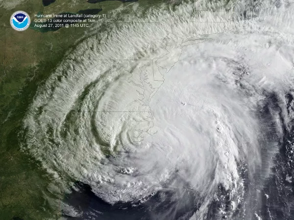
GOES-13 captured this imagery of Hurricane Irene, which battered Puerto Rico, the Bahamas, North Carolina, and the major metropolitan areas of the Northeast U.S. At its peak intensity, Irene reached Category 3 hurricane status with sustained winds of 125 miles per hour.
As part of the international Cospas-Search and Rescue Satellite-Aided Tracking (SARSAT) system, GOES-13 carries a transponder that detects signals transmitted by 406 MHz emergency beacons used by planes, ocean-going vessels, and individuals in emergency situations and relays the location data to search and rescuers.
Since the launch of GOES-1 in 1974, the GOES satellites have become forecasters’ eye in the sky, playing a vital role in providing imagery and data to forecast and track our nation’s most severe and potentially deadly weather events. The GOES program has also provided continuous and accurate imagery and data on atmospheric conditions, solar activity, and Earth’s weather systems for over 40 years. Over the decades, GOES have taken well over 3 million images.
With the next generation of weather observing satellites on the horizon, NOAA is poised to once again significantly improve weather forecasting and severe weather prediction.
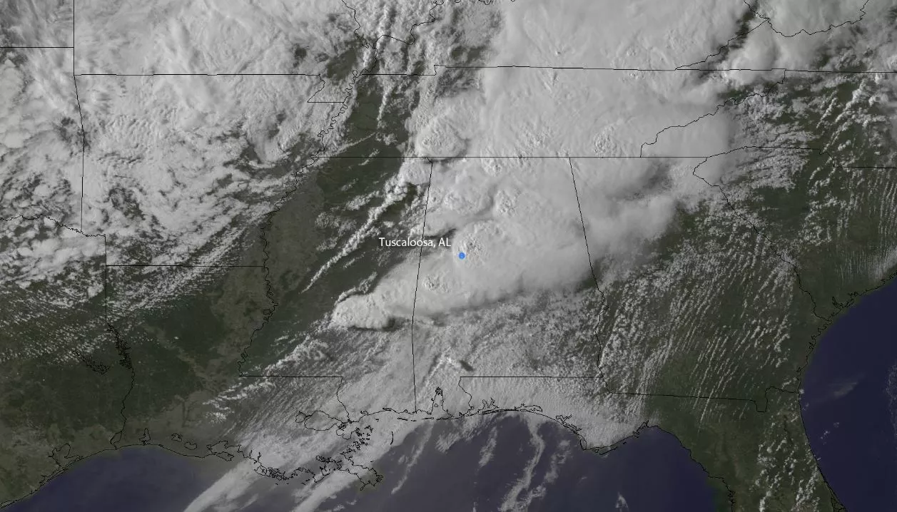
On the evening of April 27, 2011, the GOES East satellite took this picture of a supercell thunderstorm that traveled from in Newton County Mississippi to Macon County North Carolina (approximately 380 miles) and produced several strong tornadoes, one of which is now known as the Tuscaloosa-Birmingham EF-4 Tornado.
The first satellite in this series of satellites, called GOES-R, is scheduled to launch in fall of 2016.
Positioned above North America, GOES-R will scan the Earth five times faster at four times image resolution than previous GOES satellites, and triple the number of channels scientists can tap into to observe global weather and climate.
This increase in data production means satellite imagery of severe weather, like hurricanes and tornadoes, will be available in near real-time, giving forecasters even more tools to make timely warnings during a severe weather event.