
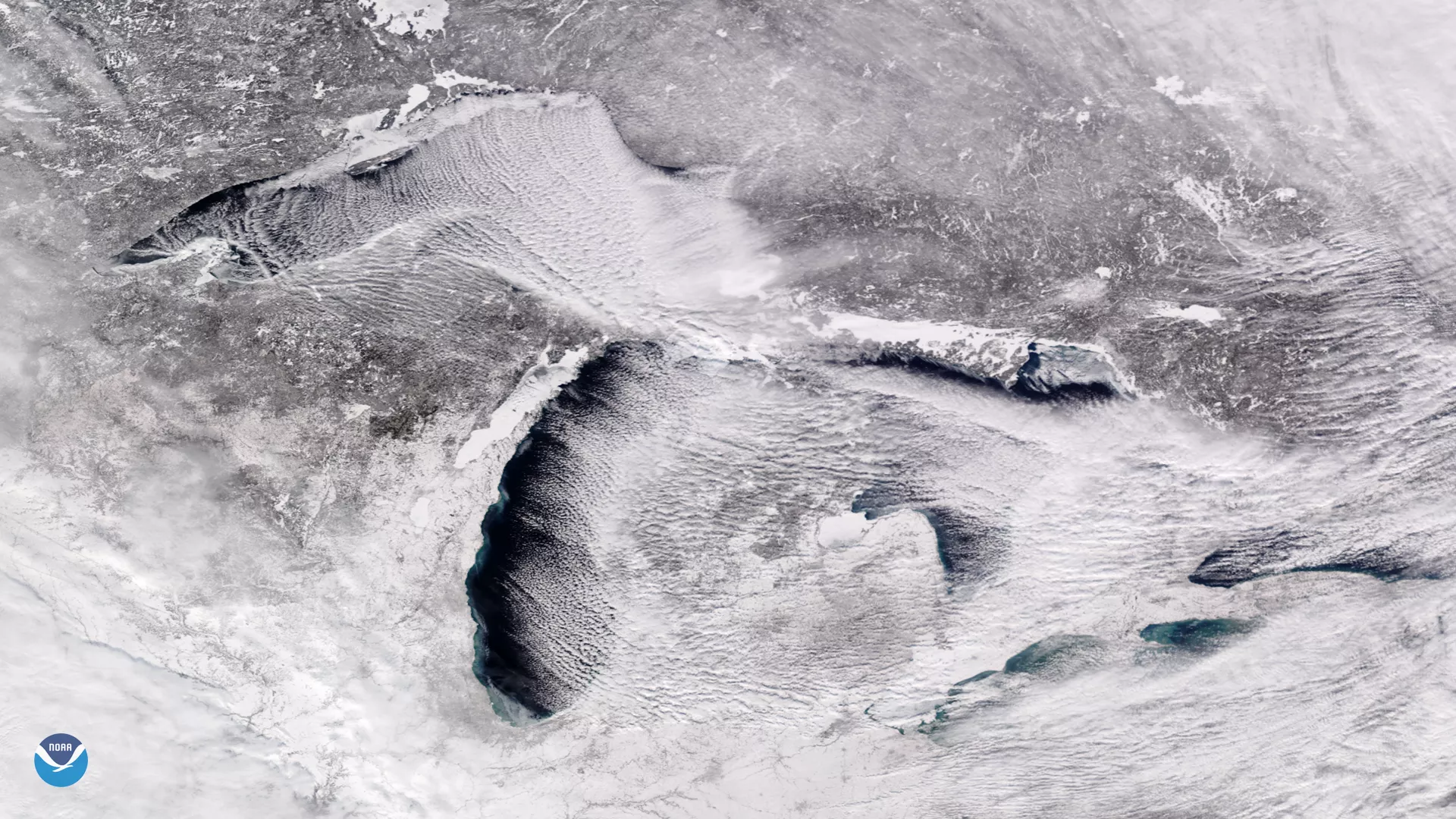
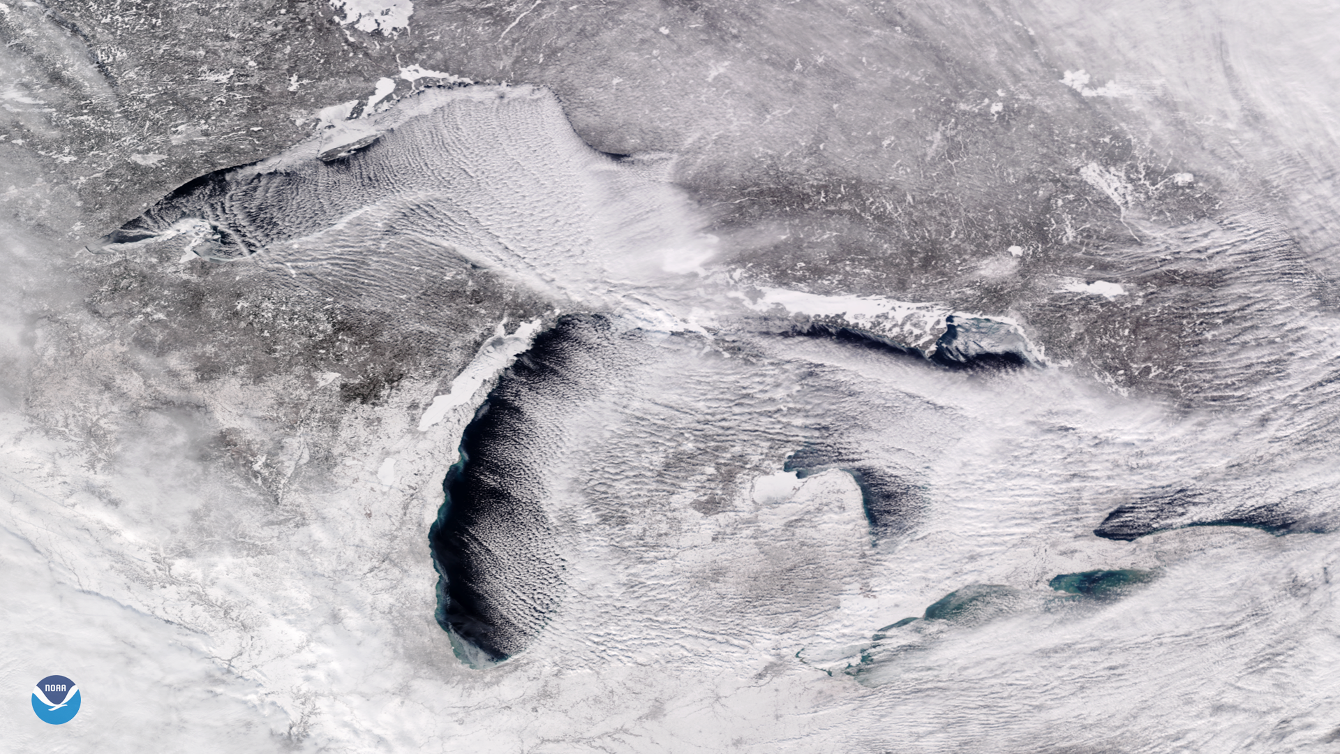
Bitter cold, arctic air is pouring into the Midwest and Great Lakes this week, and is expected to bring a prolonged period of dangerously cold temperatures and life-threatening wind chills. In this Jan. 27, 2019 image from the NOAA-20 satellite, we can see signs of the frigid weather as "cloud streets" stream over the Great Lakes.
These parallel rows of cumulus clouds are common in early-to-mid winter. When extremely cold air moves over the unfrozen, relatively warmer lake water, columns of heated air begin to rise off the lake surface. As the rising, warmer air hits the cold air above it, the moisture condenses into cumulus clouds, then cools and sinks on either side. This rising and sinking motion creates parallel cylinders of rotating air that line up in the direction of the prevailing wind (usually out of the northwest). Large temperature contrasts between the surface air and lake water can deliver heavy lake effect snow on the downwind shores of the lakes.
This week's cold air outbreak in the Midwest may set records in some locations. The National Weather Service is forecasting high temperatures to stay below zero degrees Fahrenheit from the Upper Mississippi Valley to the Great Lakes and Ohio Valley, with wind chill values as low as 60 degrees below zero in the Upper Midwest.
This true color image was captured by the VIIRS sensor on-board NOAA-20, which provides daily, high-resolution visible and infrared images of Earth's atmosphere from across the globe.