
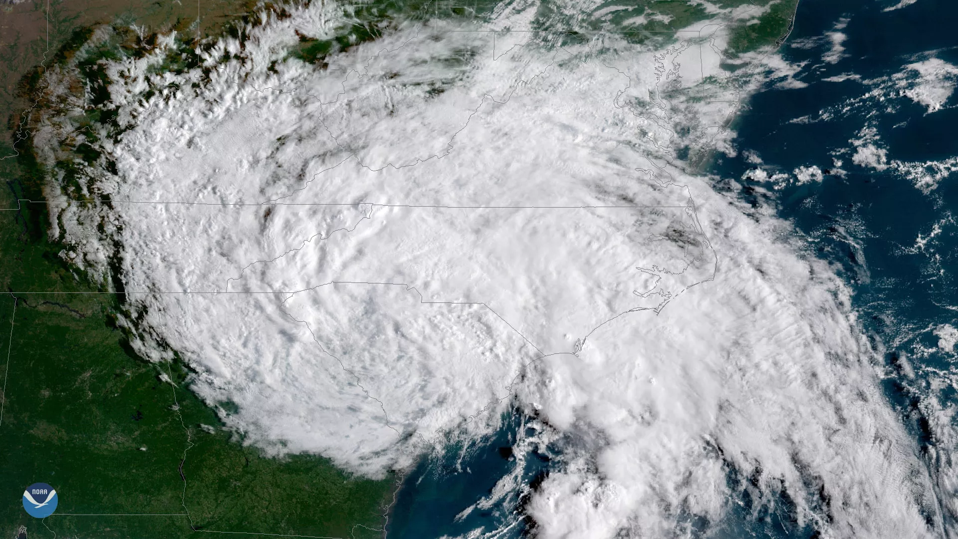
Ashore, Tropical Depression Florence with maximum sustained winds of 35 mph, continued to threaten portions of the Carolinas with flash flooding and major river flooding. This GOES East satellite image, seen at 8:45 a.m. ET on Sunday September 16, 2018, shows Florence still lingering over the Carolinas.
At 5 a.m. ET, the storm was located about 20 miles southwest of Columbia, S.C. and moving west at 8 mph. Forecasters with the National Hurricane Center (NHC) noted that Florence’s forward speed likely increased as the storm moved across the western Carolinas Sunday. Florence, according to the NHC, then curved over the Ohio Valley and Northeast U.S. Monday and Tuesday, soaking parts of the Carolinas, western Virginia and West Virginia.
Florence had already dumped record-setting rainfall on parts of North Carolina. As of 6 p.m. ET on September 15, Swansboro, N.C. had already seen preliminary rainfall totals of more than 30 inches and Hoffman, N.C. wasn’t far behind with nearly 26 inches.
Sunday shaped up as more of the same, with the NHC noting that central and western North Carolina, as well as far southwest Virginia, would see an additional 5 to 10 inches of rainfall. The NHC warned that this could produce “catastrophic flash flooding, prolonged significant river flooding and an elevated risk for landslides in western North Carolina and far southwest Virginia.” Southern North Carolina and northern South Carolina would seen an additional 4 to 6 inches while west-central Virginia would see 2 to 4 inches throughout the day.