
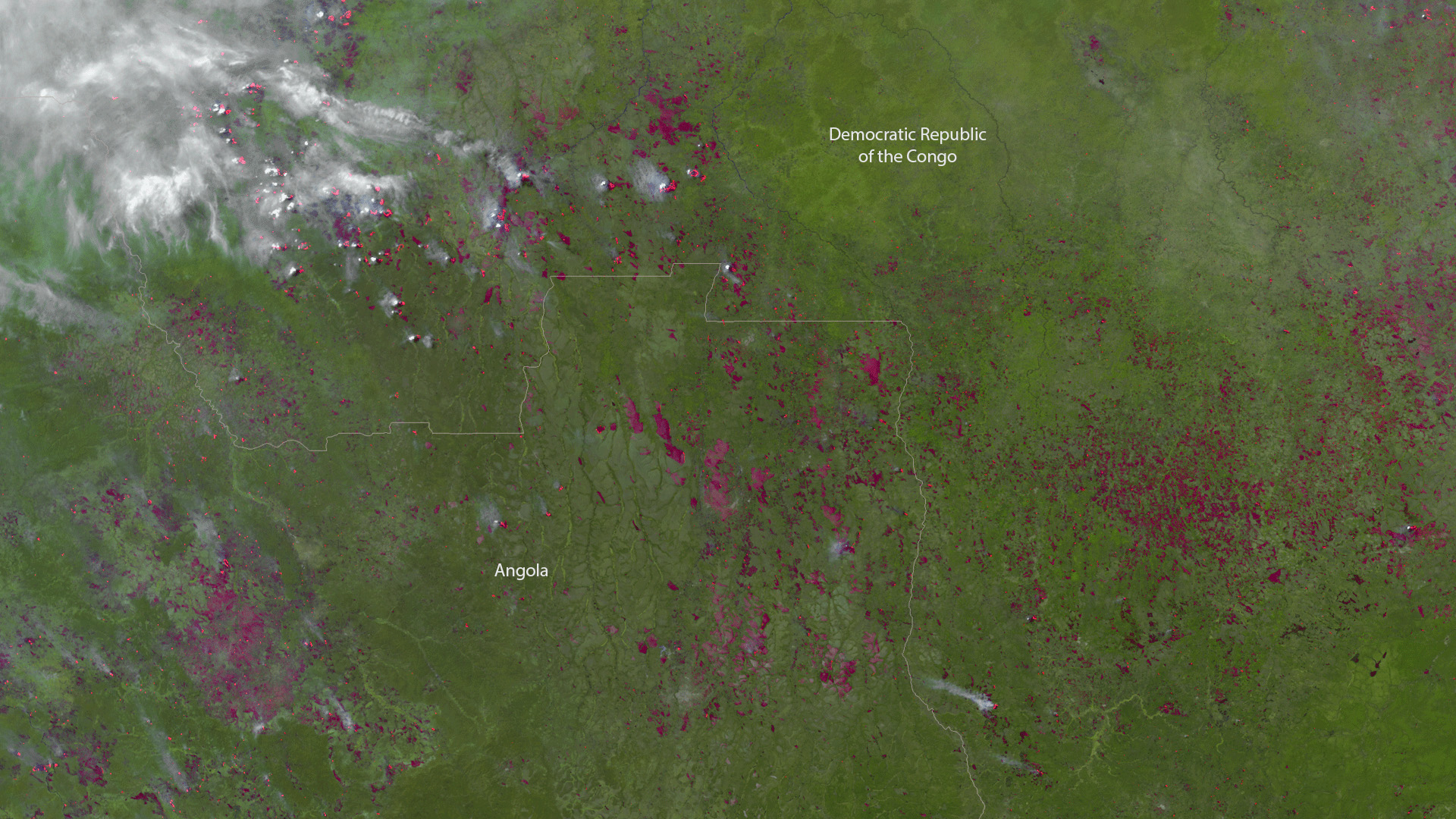
The Visible Infrared Imaging Radiometer Suite (VIIRS) aboard the NOAA/NASA Suomi NPP satellite captured this color-enhanced infrared image of fires burning in northwest Angola on June 11, 2017. This image was created with VIIRS high resolution bands 4, 2, and 1. The thermal sensitivity of band 4 generates the intense red color associated with active fires.
Every year, large parts of Africa experience widespread wildfires that are clearly visible by satellite, particularly during the dry season, which in Angola, runs from May to October. In addition to the occurrence of blazes ignited by lightning, many African farmers and herders intentionally set fire to return nutrients to the soil and to clear the ground of unwanted plants. Although these fires help enhance crops and grasses for pasture, they also produce smoke that degrades air quality.
VIIRS provides global coverage twice a day with 750 m resolution across its entire scan -- twice the coverage of its predecessors (such as the AVHRR that flew aboard NOAA's earlier polar-orbiting spacecraft). Its daily multi-band imaging capabilities support the acquisition of high-resolution atmospheric imagery and other instrument products, including visible and infrared imaging of hurricanes, atmospheric aerosols and, as shown here, detection of fires and smoke.