

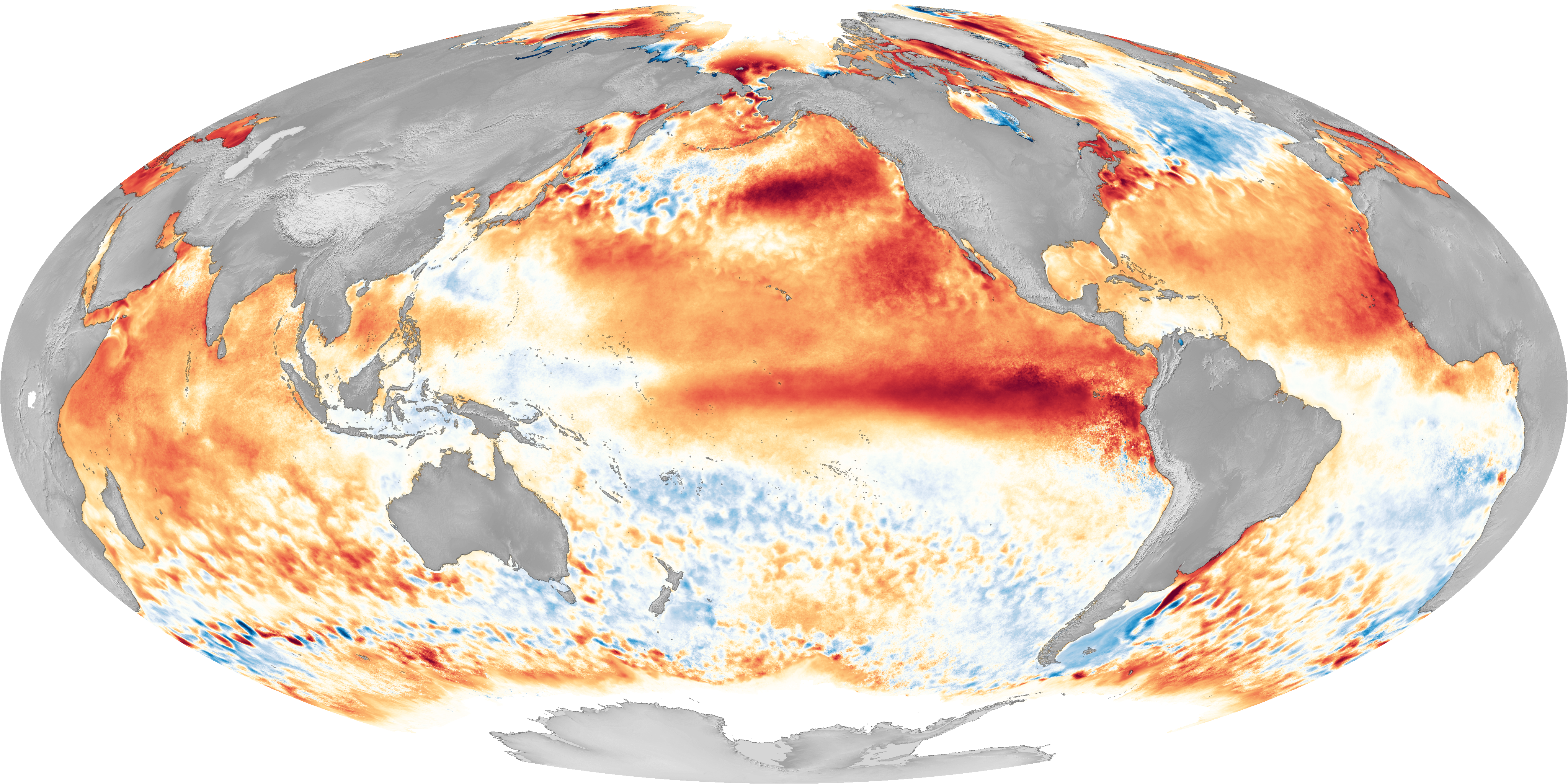
El Nino is part of a global climate cycle that typically occurs every 2 to 5 years, and is associated with warmer than normal equatorial Pacific ocean temperatures. These temperature changes may have cascading effects on global patterns of rainfall, ocean productivity, air temperature and other environmental factors. This map plots areas of sea surface temperature that are higher (red) or lower (blue) than normal. The large red “tongue” that extends west from South America is part of the characteristic pattern of warming associated with El Nino. This particular map, from 2016, shows one of the strongest El Ninos on record.