
July 17, 2020
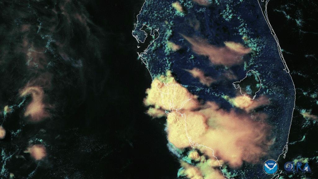
Off the west coast of Florida, NOAA’s GOES-East satellite “saw” a line of storms bubble up on July 16, 2020. The storms hit the Tampa Bay area especially hard, with towns on the coast experiencing strong-to-severe thunderstorms. According to the Storm Prediction Center, emergency managers in Manatee Co. recorded damage to several large trees at Coquina Beach, with some snapped in half and others with large branches broken off. The damage was believed to be “caused by a suspected waterspout that briefly moved onshore as a tornado.”
A combination of visible and infrared bands was used to visualize the phenomenon. For visible, Band 2, which has the finest resolution of all sixteen bands on the GOES satellites, was used to see fine details such as changes in fog/air, cloud formations, or low-level cloud drift. With the Day Cloud Phase Distinction RGB , the infrared band that shows up as “red” on the feed enables scientists to better observe rapidly developing cumulus and other details more easily, such as cloud height or temperature. “Green” and “blue,” which focuses on visual elements, can show fine details such as sand or snow (green) or water particles (blue).
The GOES-East geostationary satellite keeps watch over most of North America, including the continental United States and Mexico, the Pacific, as well as Central and South America, the Caribbean, and the Atlantic Ocean to the west coast of Africa. The satellite’s high-resolution imagery provides optimal viewing of severe weather events, including thunderstorms, tropical storms, and hurricanes.