
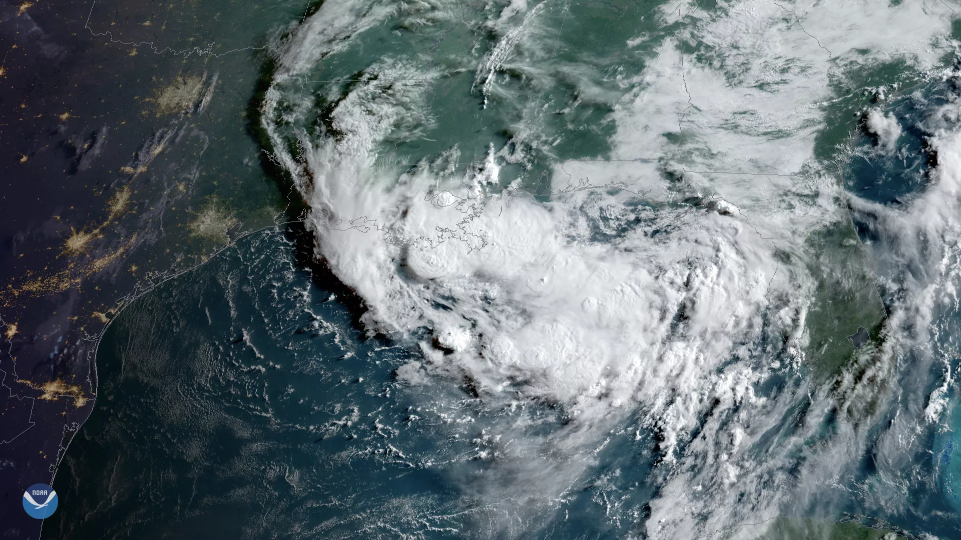
Clouds associated with a tropical disturbance bubbled up over the Gulf Coast on Wednesday, July 10, 2019. The high cloud tops over Louisiana’s Lake Pontchartrain are particularly impressive in this GOES East view.
While this tropical disturbance is slowly strengthening over the warm waters of the northern Gulf of Mexico, the system is already producing heavy rains across Louisiana. Wednesday morning, the National Weather Service (NWS) issued flash flood emergencies for New Orleans and Jefferson Parishes where 5-6 and 4-5 inches of rain have already fallen respectively. Another 2-4 inches is possible in these areas, according to the NWS.
The National Hurricane Center warns that conditions are favorable for this system to develop into a tropical depression by Wednesday or Thursday. Storm surge watches were issued from the Louisiana Coast to the upper Texas coast ahead of the storm’s development.
This GeoColor-enhanced imagery was created by NOAA's partners at the Cooperative Institute for Research in the Atmosphere. The GOES East geostationary satellite, also known as GOES-16, provides coverage of the Western Hemisphere, including the United States, the Atlantic Ocean and the eastern Pacific. The satellite's high-resolution imagery provides optimal viewing of severe weather events, including thunderstorms, tropical storms, and hurricanes.