
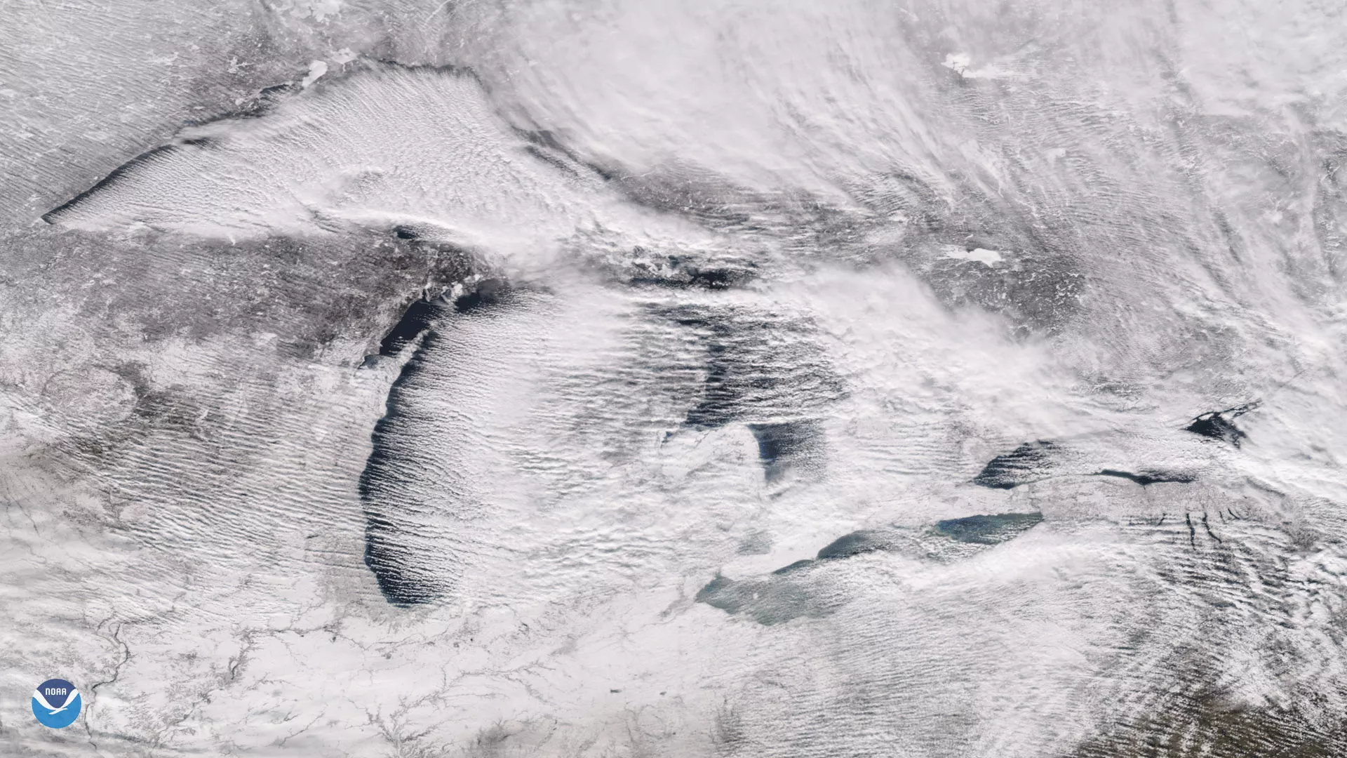
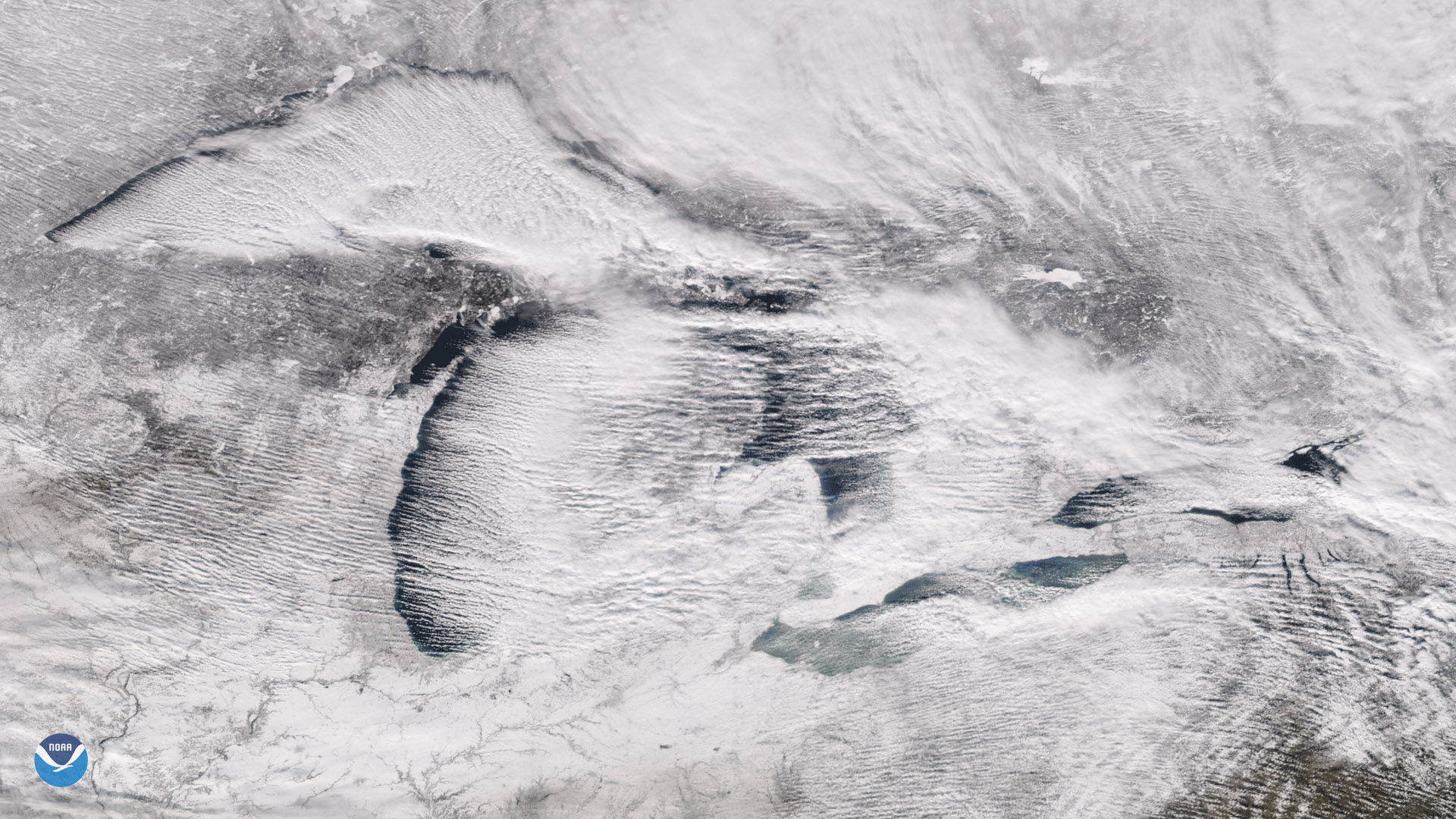
The Suomi NPP satellite's VIIRS instrument captured these parallel rows of clouds, known as "cloud streets" streaming over the Great Lakes on Christmas Day 2017. These cloud formations helped deliver record-setting snowfall in Erie, Pa., where more than 60 inches of snow fell over a two-day period.
Long, parallel rows of clouds over the Great Lakes are common in early winter, when frigid arctic air from Canada crosses the relatively warm lake water. As winds from the west or northwest blow over the lakes, the cold air picks up warmth and water vapor from the lake surface, giving rise to columns of heated air called thermals. When the rising, warmer air hits the colder air above, it condenses into cumulus clouds, then cools and sinks on either side, creating parallel cylinders of rotating air that line up in the direction of the prevailing winds over the lakes. At times when there is a large temperature contrast between the surface air and lake water, these cloud formations can deliver heavy lake effect snows on the downwind shores of the lakes.
Although true-color images like this may appear to be photographs of Earth, they aren't. They are created by combining data from the three color channels on the VIIRS instrument sensitive to the red, green and blue (or RGB) wavelengths of light into one composite image. In addition, data from several other channels are often also included to cancel out or correct atmospheric interference that may blur parts of the image.