

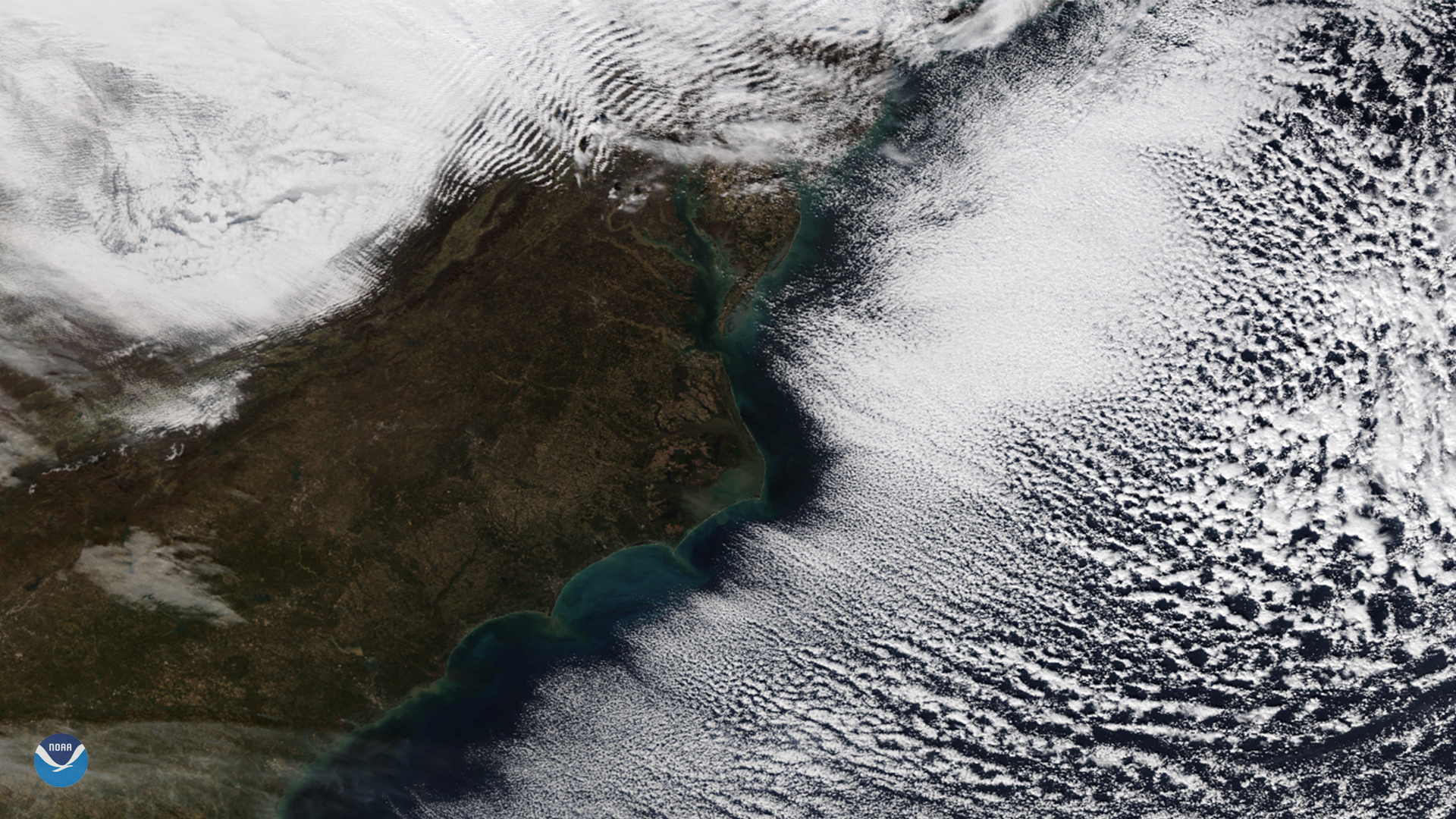
Wispy, parallel lines of clouds appeared off the coast of the Mid-Atlantic and Southeast U.S. in this image captured by the NOAA-20 satellite on Nov. 28, 2018. Known as "cloud streets," these parallel bands of cumulus clouds are often visible in satellite imagery during the colder months of the year, especially in late fall and early winter.
On Nov. 28, a cold front associated with a large storm over the Northeast delivered gusty winds to the Mid-Atlantic. As the front moved offshore, the cold air picked up heat and moisture from the relatively warm waters of the Atlantic, giving rise to columns of heated air called thermals.
When the rising, warmer air hits the colder air above, it condenses into cumulus clouds, then cools and sinks on either side. This rising and sinking motion creates parallel cylinders of rotating air that line up in the direction of the prevailing wind. The orientation of the clouds in this satellite image tells us that winds were mainly out of the northwest.
Notice how there is a gap between the coastline and area where the cloud rows begin. Skies are clear near the coast because the cold air has not traveled far enough over water to pick up the heat and moisture needed to form clouds.
Over land, we can also see multiple rows of parallel clouds over the Appalachians, from western Virginia to Pennsylvania. These wave clouds, called "gravity waves," form when stable air moves over hills and mountains. As the air flows over the Appalachians, it encounters changes in air density that cause the air to oscillate. These waves are similar to the ripples that form when you drop a stone in a pond.
This true color image was captured by the VIIRS sensor on-board NOAA-20, which provides daily, high-resolution visible and infrared images of Earth's atmosphere from across the globe.