
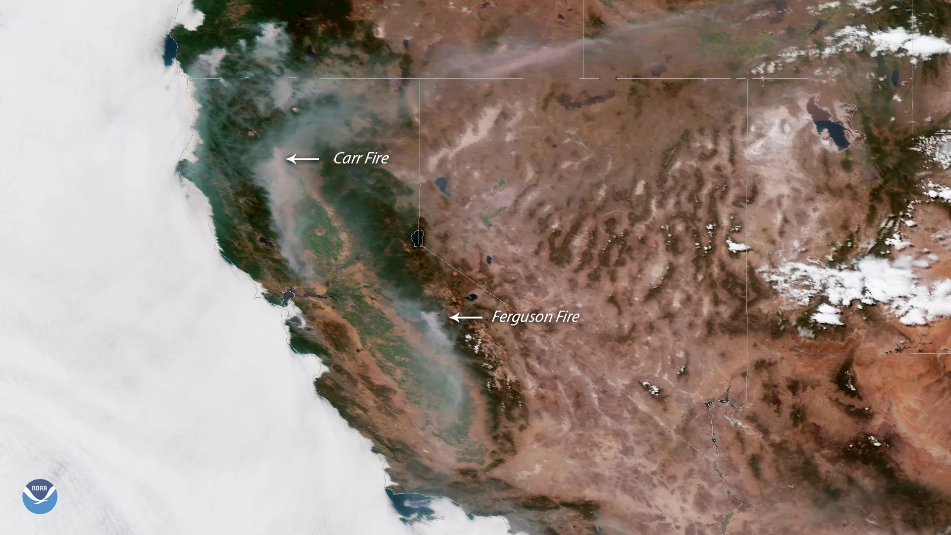
Plumes of hazy smoke stretch across California and southern Oregon, as large wildfires continue to burn in the Western U.S. This GOES East satellite image, captured on July 27, 2018, shows the site of California's two largest blazes: The rapidly growing Carr Fire, seven miles northwest of Redding, and the Ferguson Fire near Yosemite National Park.
Today's update from the California Department of Forestry and Fire Protection (Cal Fire) said the Carr Fire had more than doubled in size in just 24 hours. The fire now covers more than 44,000 acres and is only 3 percent contained. According to media reports, the inferno has killed two people and is threatening hundreds of homes. State officials have ordered several thousand people to evacuate.
The National Weather Service issued a red flag warning for parts of northern California, indicating critical fire danger due to hot, dry conditions and gusty winds. In Redding, temperatures are expected to approach 110 degrees Fahrenheit on Friday and into the weekend.
Farther south, firefighters continue to battle the two-week-old Ferguson Fire in Mariposa County, which has now burned more than 45,000 acres. The enormous blaze, which closed large parts of Yosemite National Park this week, is now 29 percent contained.
This geocolor enhanced imagery was created by NOAA's partners at the Cooperative Institute for Research in the Atmosphere. The GOES East geostationary satellite, also known as GOES-16, provides high-resolution visible and infrared imaging of severe weather events, including thunderstorms, hurricanes and tropical storms and, as shown here, detection of fires and smoke.