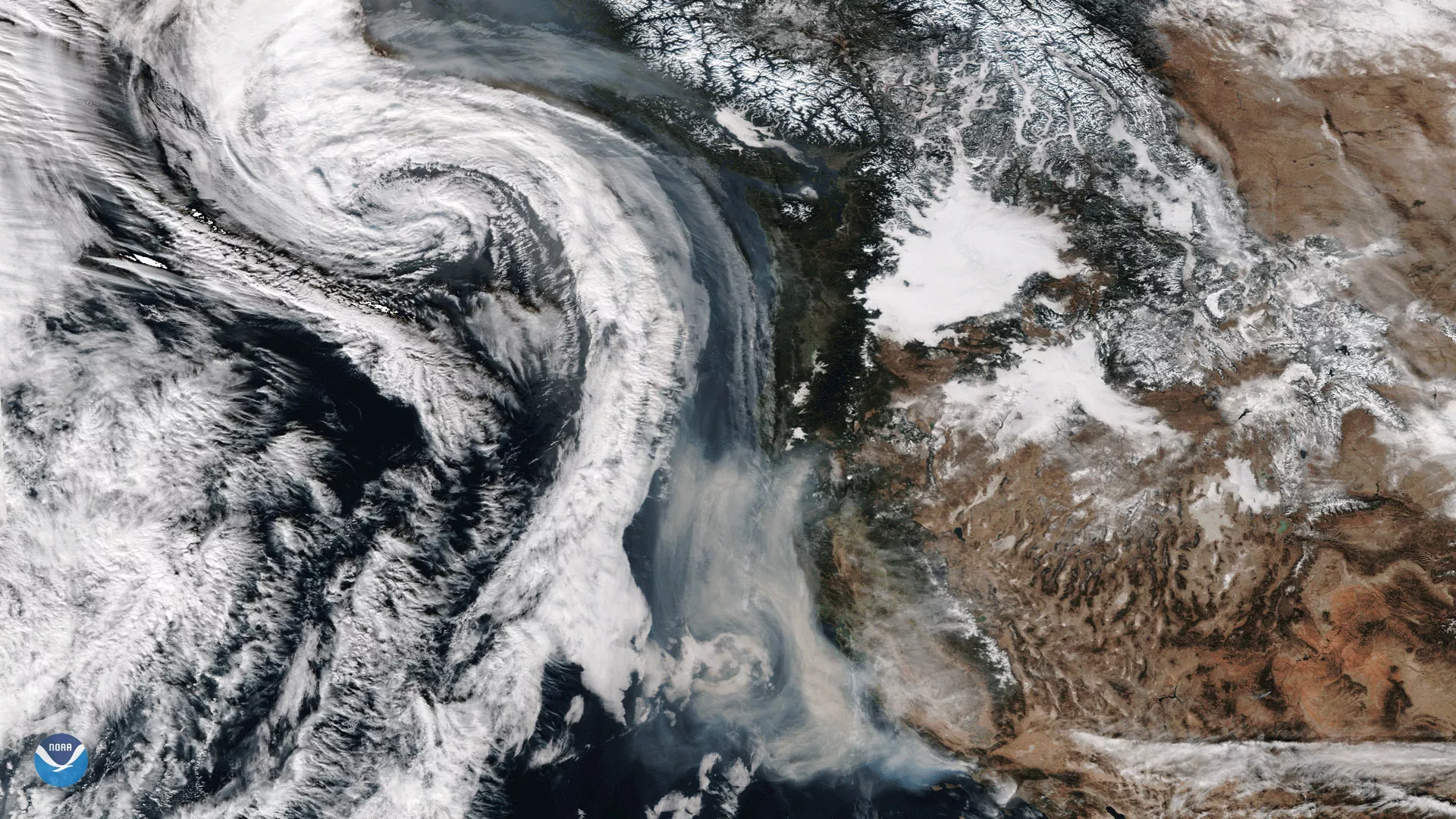
The Suomi NPP satellite's VIIRS instrument took this image of smoke from California's wildfires being drawn northward into an approaching storm system off the U.S. Pacific Coast on December 11, 2017. The beige-colored smoke is visible in the lower-center portion of this image, while the comma-shaped storm system, known as a mid-latitude cyclone, is seen just to the west. Southerly winds ahead of the storm are pushing wildfire smoke several hundred miles northward, parallel to the coastline. The Thomas Fire in southern California has scorched more than 230,000 acres in recent days and is the fifth-largest in state history.
Although true-color images like this may appear to be photographs of Earth, they aren't. They are created by combining data from the three color channels on the VIIRS instrument sensitive to the red, green and blue (or RGB) wavelengths of light into one composite image. In addition, data from several other channels are often also included to cancel out or correct atmospheric interference that may blur parts of the image.