
January 30, 2020
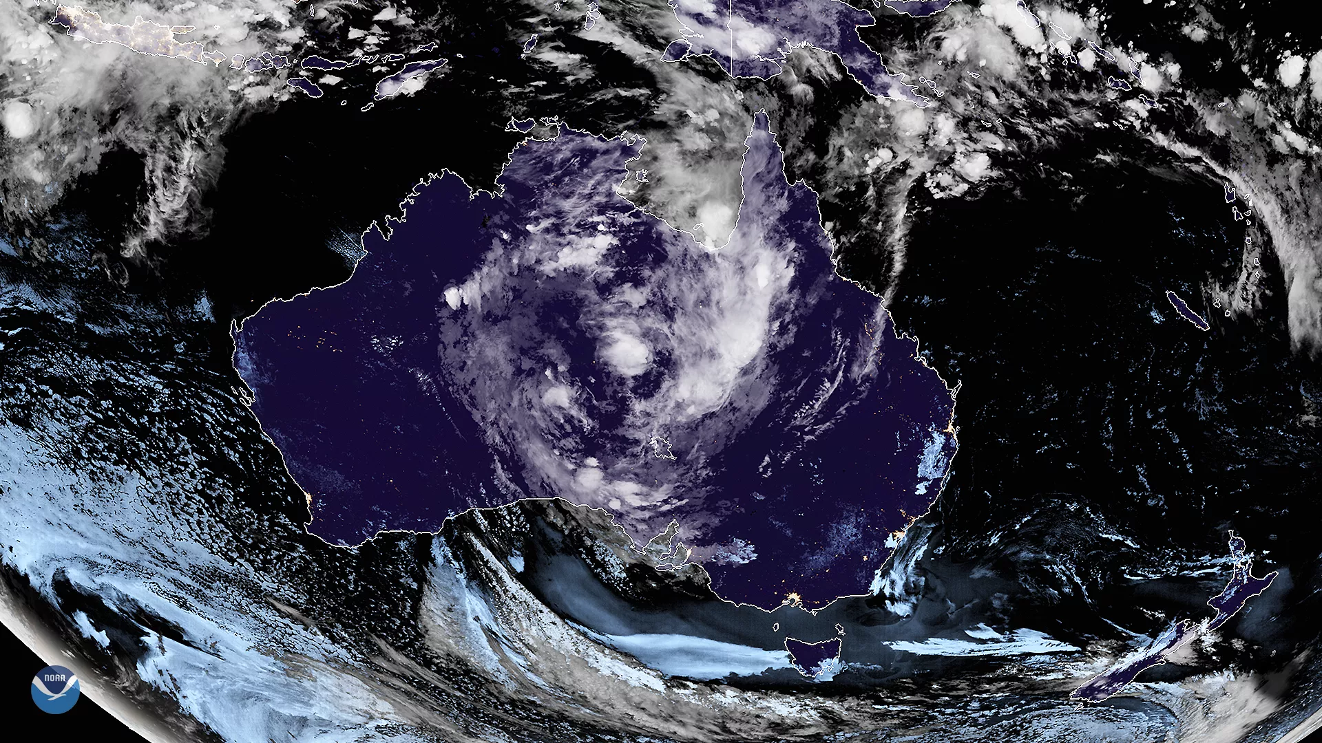
On Jan. 30, 2020, the Himawari-8 satellite viewed a developing storm system in the center of the Australian continent, bringing rains and high winds. According to Australia’s Bureau of Meteorology (BOM), “[clouds] and thunderstorms over [central Australia are] associated with surface troughs and a tropical low centered over southern Northern Territory.” While the agency canceled severe thunderstorm warnings for areas in the Northern Territory and South Australia , there are still flood watches for parts of South Australia, with “high levels of tropical moisture [moving] into the north of South Australia...and then...into central and southeast” for the next 72 hours.
Meanwhile, fire weather is more of a risk at the coastal regions, where, the government has issued a fire weather warning in parts of Western Australia due to hot, southeasterly winds blowing over the West Pilbara Coast. To the east, the beleaguered state of New South Wales (NSW) will experience “warm, dry, and windy conditions” that will bring additional fire threats to the southeast on Friday.
Throughout both flooded and fire-affected areas, the BOM has issued advisories for a heatwave this upcoming weekend, stating that “low to severe heatwave conditions are forecast [for] Western Australia...eastern Victoria, eastern NSW, and southern Queensland.” Most notably, temperatures in Canberra (Australia’s capital city) are expected to reach 105 degrees Fahrenheit on Friday; however, lower temperatures and rain will likely come by Monday morning.
This image was captured by the Advanced Himawari Imager (AHI) on Japan’s Himawari-8 satellite. This satellite, the first unit of the Japan Meteorological Agency's (JMA) third-generation of geostationary satellites, provides visible light and infrared images of the Asia-Pacific region. Himawari's data are vital for global geostationary coverage, which is why NOAA and JMA have agreed to mutual back-up arrangements for their geostationary systems.