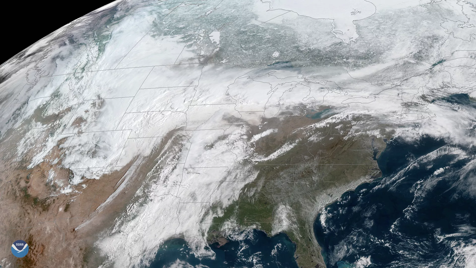
GOES East captured this image of the powerful spring storm system that will deliver a wide mix of weather impacts across the southern, central and eastern United States through the upcoming weekend. The storm, currently centered over the Central Plains, is bringing cold air, heavy snow and strong winds to the northern Plains, while severe thunderstorms, tornadoes, and hail are possible in parts of the lower Mississippi Valley and the Midwest. The National Weather Service has issued blizzard warnings from eastern Colorado to South Dakota, where more than a foot of snow is expected in some areas through the weekend. A cold front riding along the storm's southern flank helped funnel hot, dry winds into southern Plains yesterday, where extremely low humidity and wind gusts above 50 mph fueled significant wildfires in Oklahoma, western Texas, and New Mexico.
As the storm approaches the East Coast late this weekend, it will bring heavy rain and plummeting temperatures, ending the summerlike warmth currently affecting the eastern U.S.
This geocolor enhanced imagery was created by NOAA's partners at the Cooperative Institute for Research in the Atmosphere. The GOES East satellite, also known as GOES-16, provides geostationary satellite coverage of the Western Hemisphere, including the United States, the Atlantic Ocean and the Gulf of Mexico. First launched in late 2016, the satellite became fully operational in December 2017.