
Search
Showing 25 - 32 of 142 results
News

A massive winter storm recently made its way across the U.S. Parts of Texas, Oklahoma and Kansas were blasted by severe…
News

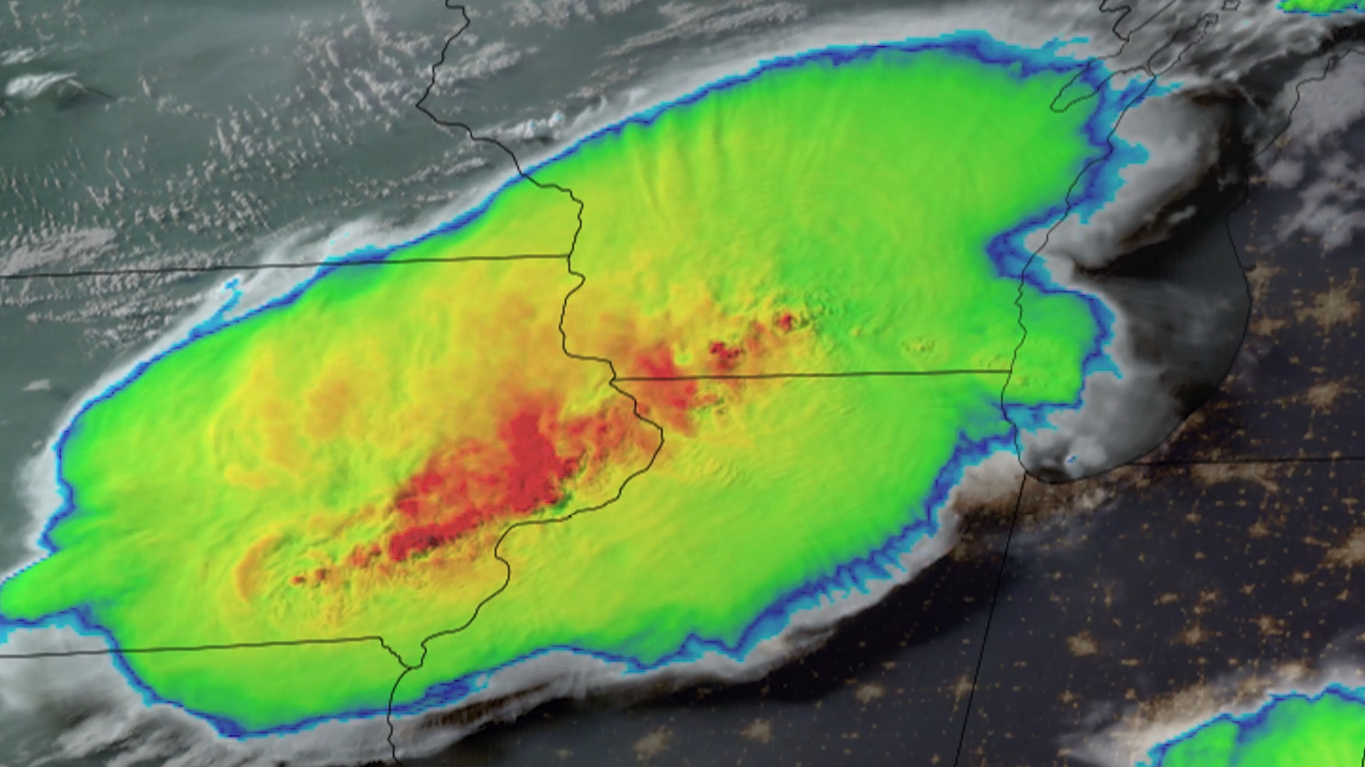
Severe thunderstorms struck Texas. The storms formed along a dry line—a boundary between moist and dry air. The storms…
News
Parts of the Midwest are cleaning up after thunderstorms barreled through the region on the night of Monday, July 15, 2024,…
News
NOAA’s GOES East (GOES-16) satellite watched severe thunderstorms that brought tornadoes, damaging winds and flooding rain…
Educational Resource

Hurricanes, tornadoes, heat waves, and severe snowfalls happen more often than ever. We rely on spacecraft orbiting Earth to…
News
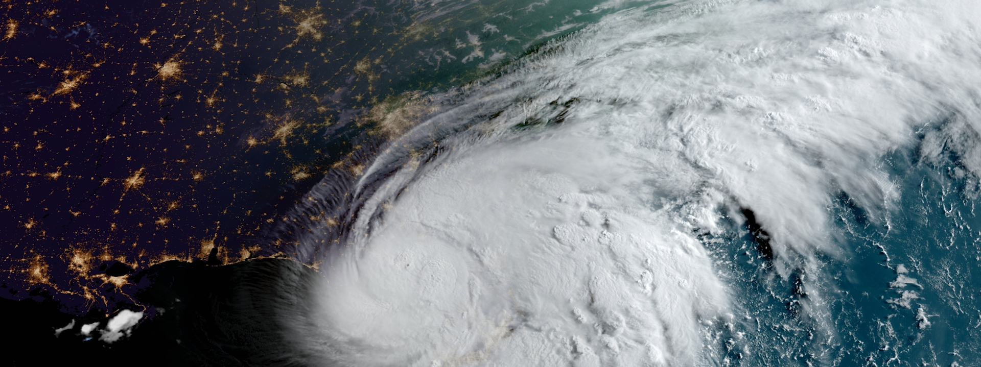
Last week, NOAA satellites tracked Debby, a storm that impacted Florida’s Big Bend region near Steinhatchee before moving up…
News

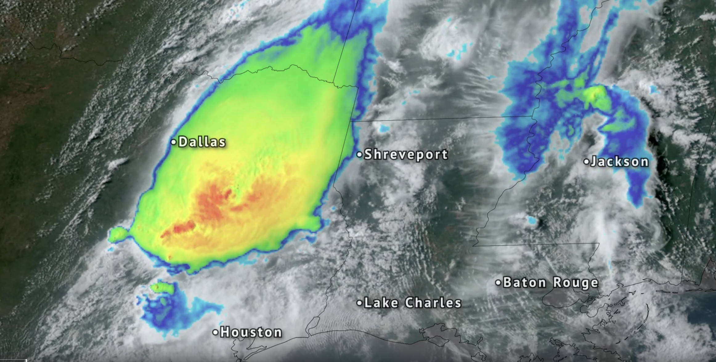
NOAA satellites have been tracking a major spring storm system pushing across the central United States this week. The…
News

Severe storms that began rolling through the southern U.S. on Friday, March 24, 2023 left a path of devastation from Texas…