
Search
Showing 1 - 8 of 56 results
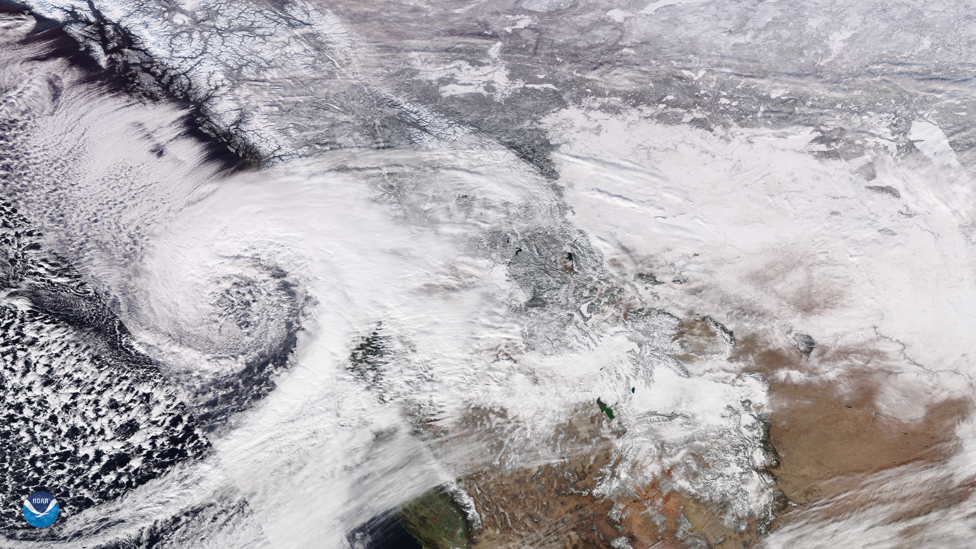
On Jan. 15, NOAA-20 viewed a low pressure system that has been bringing snowfall into British Columbia, Canada since Jan. 10…
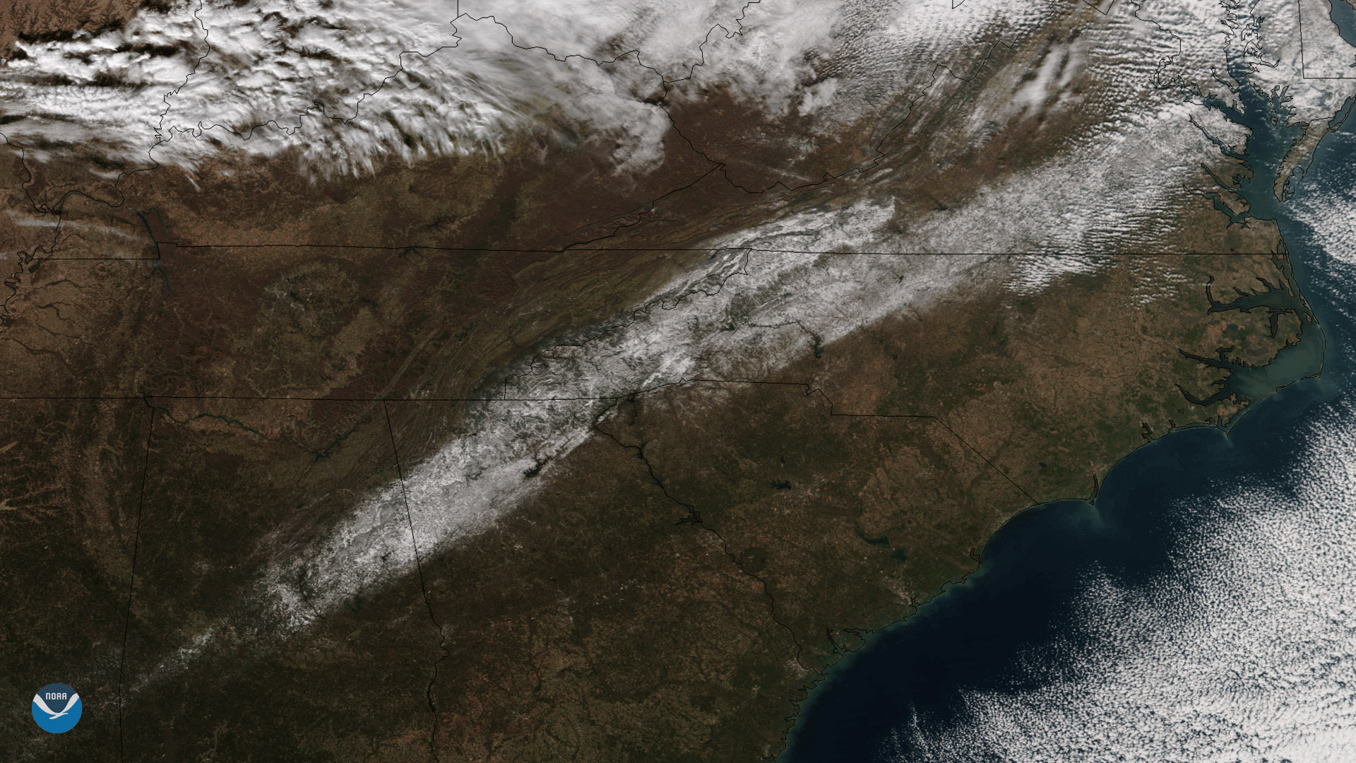
December 11, 2017 NOAA/NASA's Suomi NPP satellite captured this image of an unusual early-season snow that fell across…
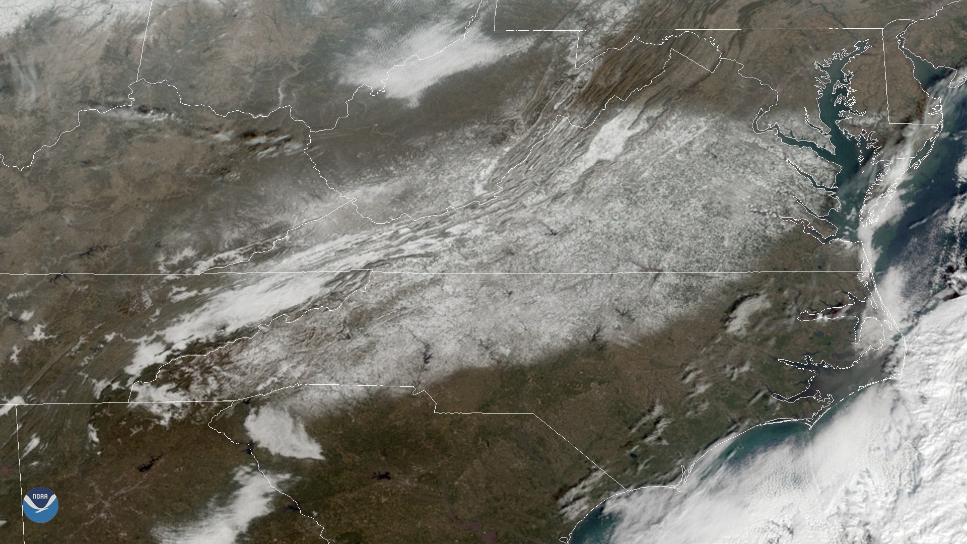
GOES East captured heavy snow cover over the Mid-Atlantic region on Dec. 11, 2018.
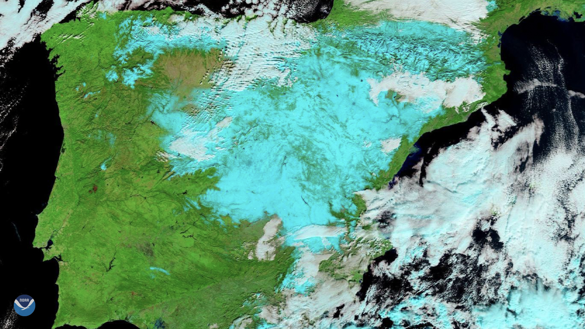
On Jan. 11, 2021, Europe’s Meteosat-11 satellite captured imagery of the aftermath of…
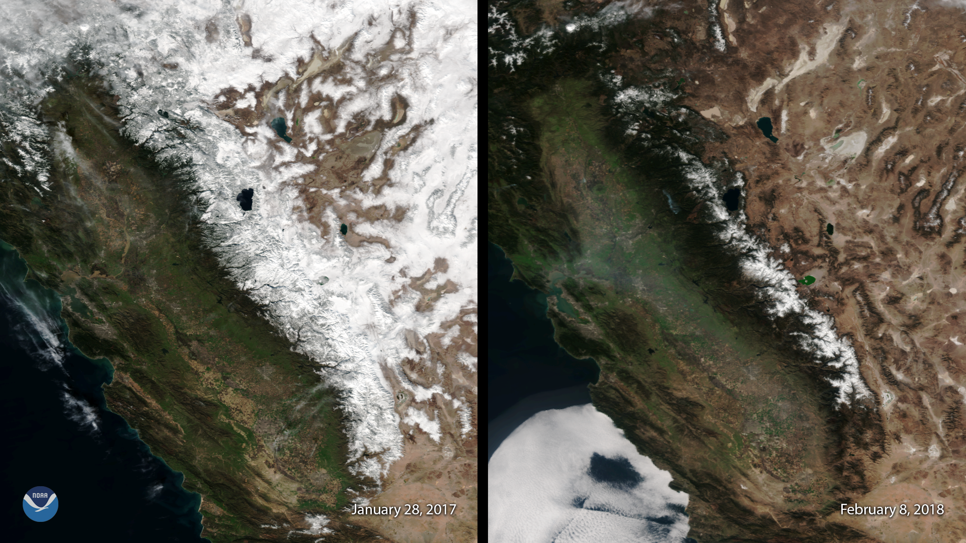
February 08, 2018 This image, captured by the Suomi NPP satellite's VIIRS instrument compares current snow cover in the…
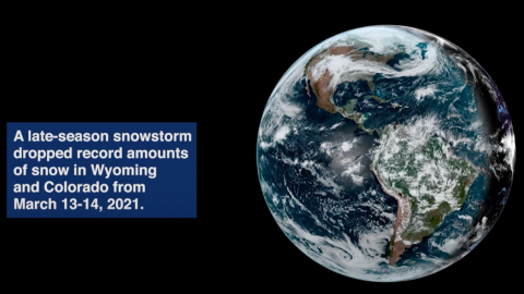
Satellite imagery shows a late-season snowstorm that dropped record-breaking amounts of snowfall in Cheyenne, Wyoming and…
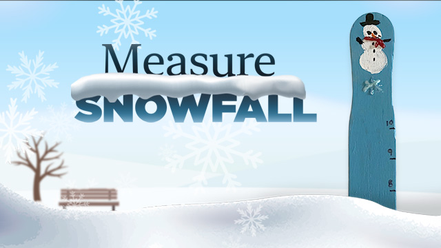
Predicting snowfall amounts is part of NOAA’s mission, and so is measuring the amount of snow already on the ground. Snow…
Earth-observing satellites like the Joint Polar Satellite System (JPSS) help scientists measure snowfall in remote areas…