
Search
Showing 65 - 72 of 628 results
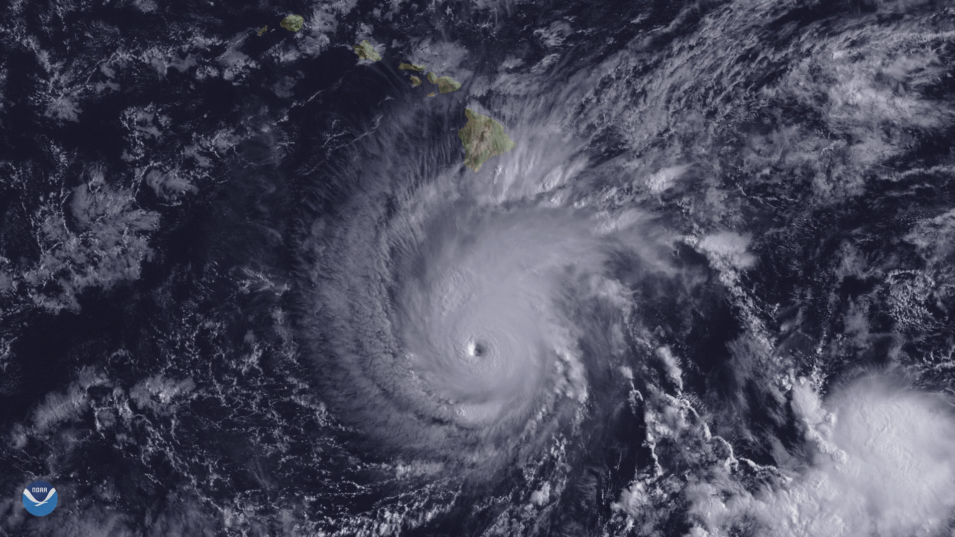
The state of Hawaii faces a significant threat from powerful Hurricane Lane, which is expected to track northward toward the…
NOAA just updated its 2020 Atlantic Hurricane Season Outlook.
Hurricane Delta is expected to swing up over the warm waters of the Gulf of Mexico and make landfall along the northern Gulf…
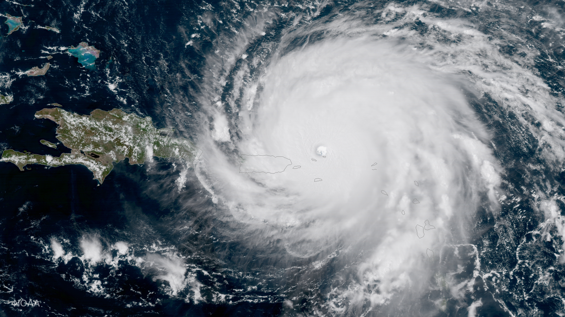
GOES-16 captured this geocolor image of Hurricane Irma -- a category 5 storm with winds as high as 185 miles per hour.
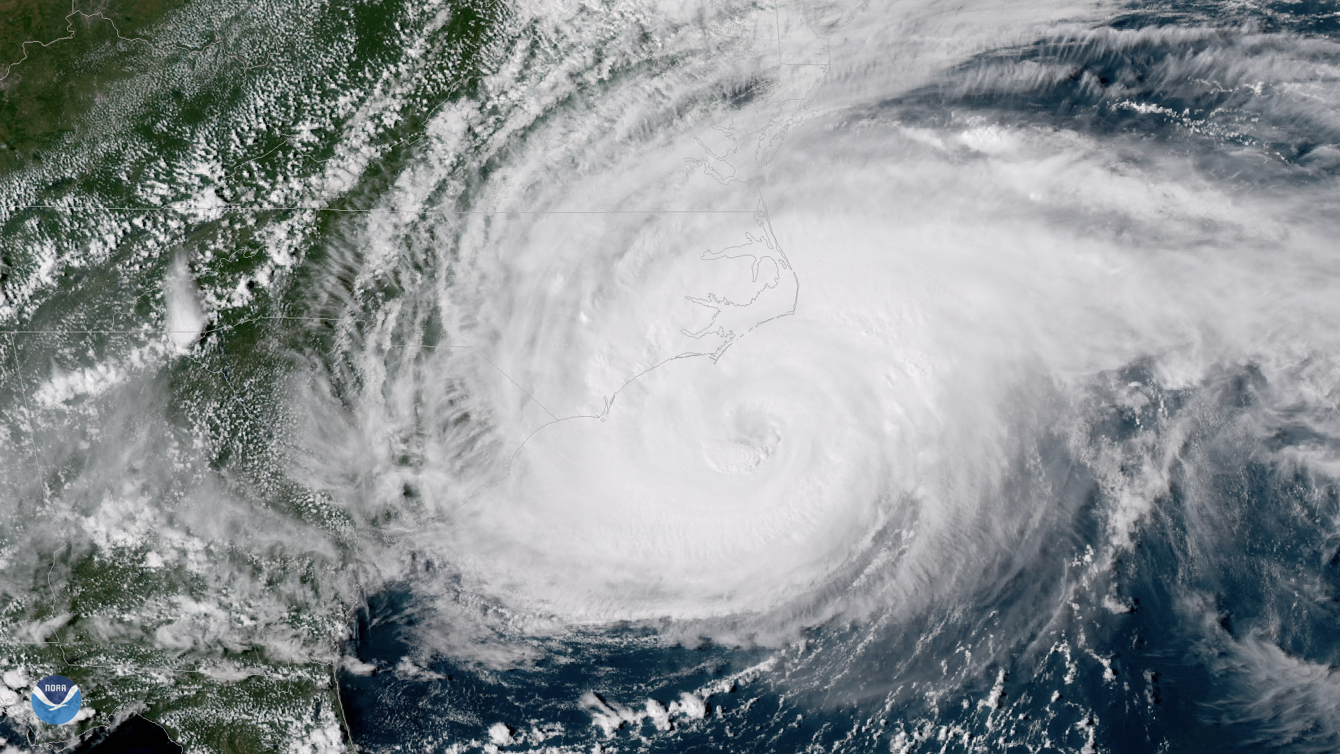
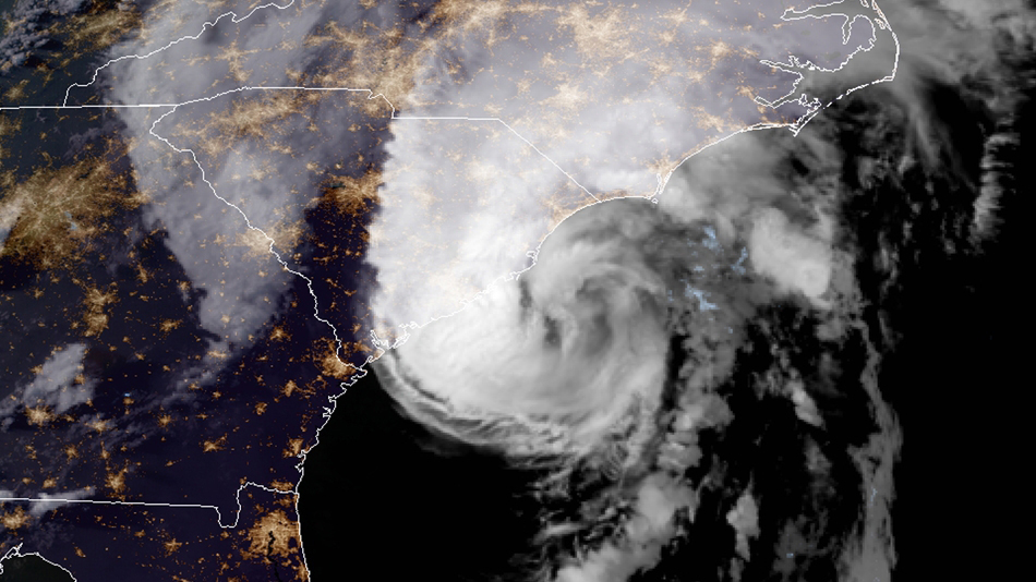
The outer bands of Hurricane Florence batter the North Carolina coast, September 13, 2018
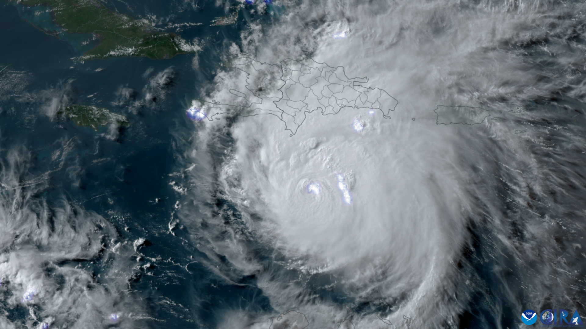
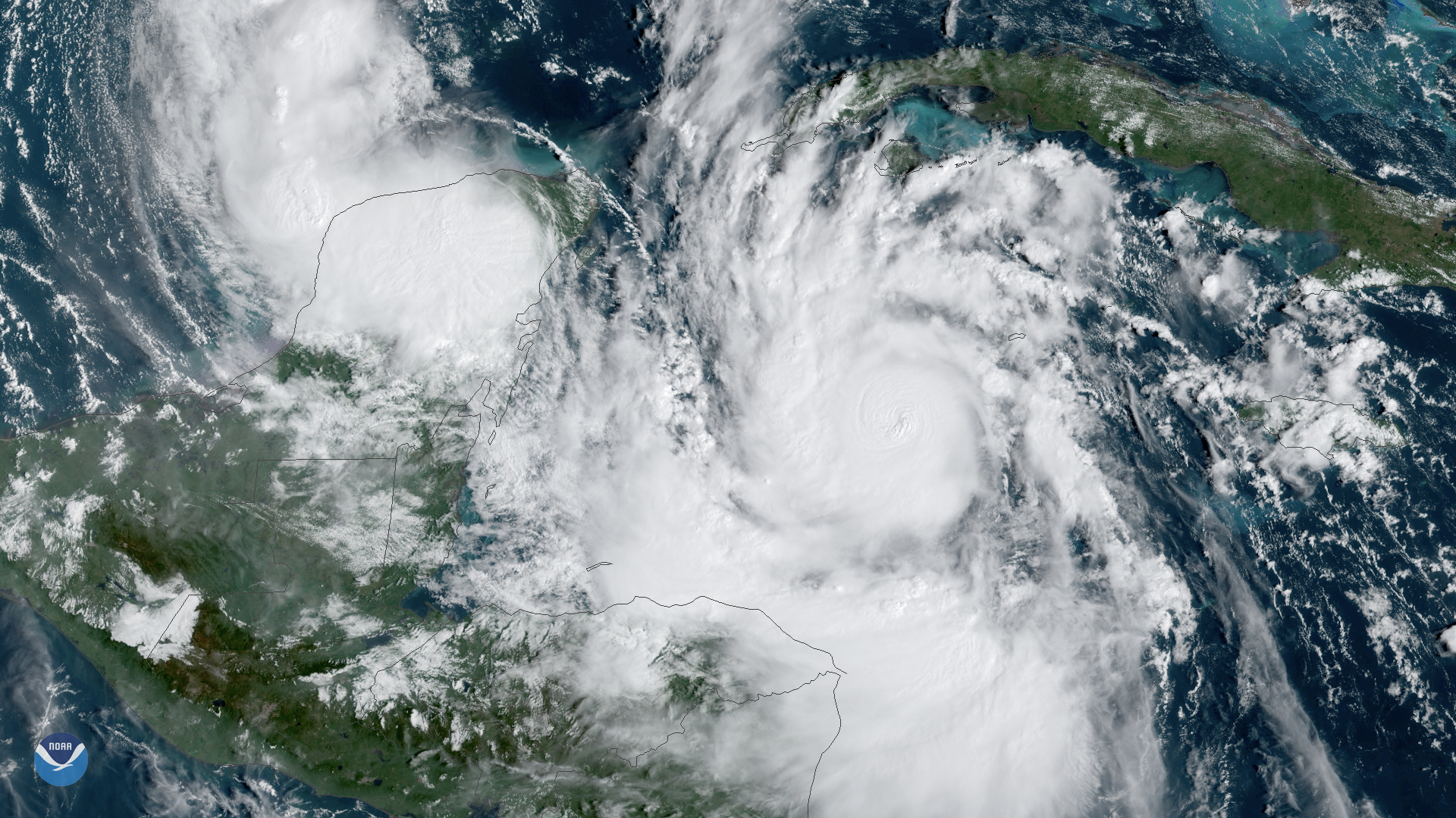
NOAA’s GOES East (GOES-16) satellite has been carefully monitoring Hurricane Beryl as it travels across the Caribbean.…

The NOAA/NASA Suomi NPP satellite captured this infrared image of Hurricane Harvey on August 25, 2017 at 18:55 UTC.
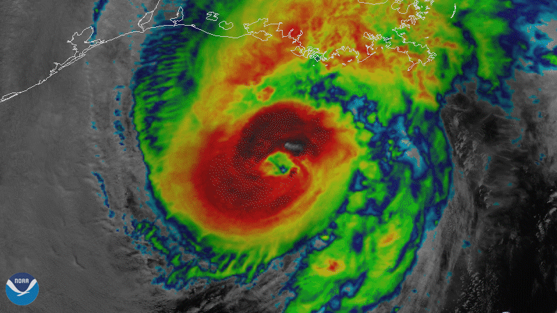
On October 28, 2020, NOAA’s GOES-East satellite viewed Hurricane Zeta make landfall at Cocodrie, Louisiana as a strong…