
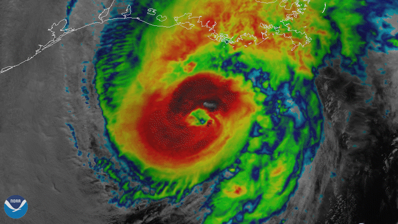
On October 28, 2020, NOAA’s GOES-East satellite viewed Hurricane Zeta make landfall at Cocodrie, Louisiana as a strong Category-2 storm on the Saffir-Simpson Wind Scale. Just after landfall, there was a report of winds of 112 mph in Bayou Bienvenue, La., which is 100 miles away from Cocodrie. Wind gusts of more than 100 mph were reported as far away as southeastern Mississippi.
As it quickly tracked northeastward, Zeta brought high winds and power outages to far-inland areas of the Southeast as well. Columbus, Ga. reported winds of 56 mph and Atlanta saw winds of 52 mph. Several media outlets reported that Zeta left more than 2 million people without power from Louisiana to the Carolinas.
The above imagery uses GOES-East’s ABI band 13 and band 3, which is otherwise known as a sandwich loop. It provides exceptional detail both during the day and in low light conditions (band 3) with the temperature information of infrared (band 13).
The GOES-East geostationary satellite, also known as GOES-16, keeps watch over most of North America, including the continental United States and Mexico, as well as Central and South America, the Caribbean, and the Atlantic Ocean to the west coast of Africa. The satellite's high-resolution imagery provides optimal viewing of severe weather events, including thunderstorms, tropical storms, and hurricanes.