
Search
Showing 49 - 56 of 310 results
Page
Nor'easters are storms that form along the East Coast of North America and can bring dangerous wind, snow, rain and…
News

Severe storms struck the South Central U.S. (Louisiana and Texas), producing heavy rain, extensive flooding, damaging winds…
Event
Nov 7 2022
November 7, 22
William Sweet is a NOAA Oceanographer spearheading efforts to track and predict changes in sea level and coastal flood risk…
Event
Apr 21 2025
April 21, 25
CRREL’s Ice Jam Program tracks river ice floods to aid planning, using diverse data to improve detection, records, and…
Page
NOAA’s satellites monitor the Earth’s environment in real-time every day, capturing storms, floods, fires, lightning, and…
News
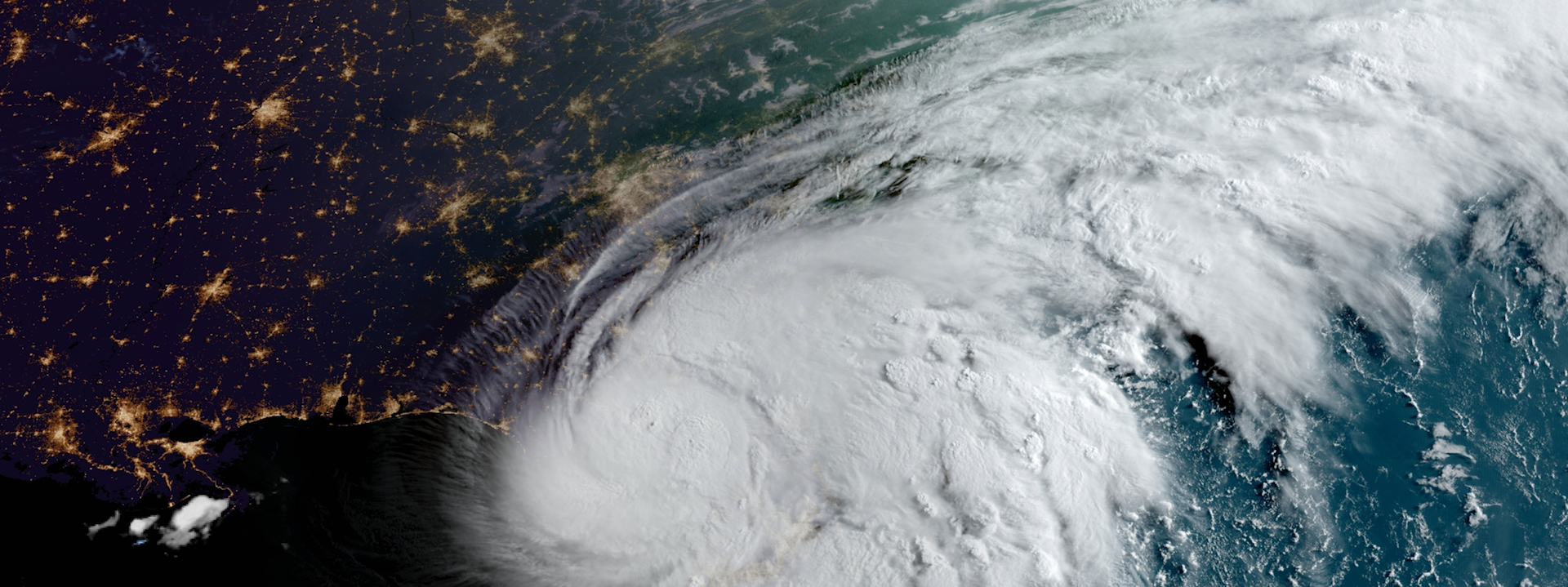
Last week, NOAA satellites tracked Debby, a storm that impacted Florida’s Big Bend region near Steinhatchee before moving up…
News

NOAA’s satellite imagery and data were the foundation of 2019’s life-saving forecasts throughout the 14 billion-dollar…
Page
Severe weather is classified as a series of events that can cause destructive or deadly effects on the ground. It…