
A series of winter storms making their way across the country are expected to make travel conditions challenging, if not impossible, this Thanksgiving weekend.
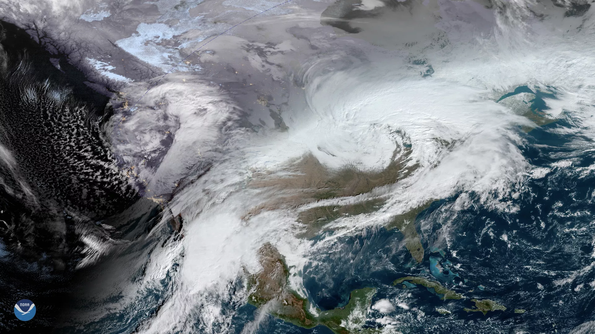
In the West, a historically powerful and rare mid-latitude cyclone that developed over the Pacific on Tuesday, Nov. 26 has made landfall over southern Oregon and Northern California. This large low-pressure system developed rapidly, dropping more than 24 millibars, a measure of atmospheric pressure, over 24 hours—the lower the pressure, the stronger the storm. This rapid strengthening, known as bombogenesis, is bringing strong winds, with gusts up to 100-mph along the coast, and multiple feet of snow to the mountains. With central pressure near 970 millibars, the storm has set a record for the month of November and is gradually weakening as it moves inland.
“This is an unprecedented storm, given the track and strength, and will bring very dangerous conditions to the area,” the National Weather Service in Medford, Oregon said in an article from USA Today. Winter weather advisories and storm warnings are still in effect around the region.
Moving eastward, another large storm system is tracking across the Great Lakes today, Nov. 27, heading toward New England by tonight. Very windy conditions are expected across a majority of the Midwest, Ohio Valley, and Northeast where winds could gust more than 50 mph.
High wind warnings and advisories are also in effect further south, spanning from the greater Kansas City area to the Mid-Atlantic region. There are also winter storm warnings across parts of the Upper Midwest, which may see moderate to heavy snowfall.
Elsewhere, areas of the Southeast U.S. to the Mid-Atlantic and New England may see showers and a few thunderstorms. The wind gusts may be so strong in New York City, that the Macy’s Thanksgiving Day Parade balloons may not fly for the first time since 1971.
Please stay safe if you plan to travel for the holiday.
This GeoColor enhanced image is a combination of views from both the GOES East and GOES West satellites, which provide coverage of different areas of the Western Hemisphere. The GOES East geostationary satellite, also known as GOES-16, keeps watch over the United States, the Atlantic Ocean, and the eastern Pacific. The satellite's high-resolution imagery provides optimal viewing of severe weather events, including thunderstorms, tropical storms, and hurricanes. The GOES West satellite, also known as GOES-17, keeps watch over the Pacific Ocean, Alaska, and Hawaii. First launched in March 2018, the satellite became fully operational in February 2019.