
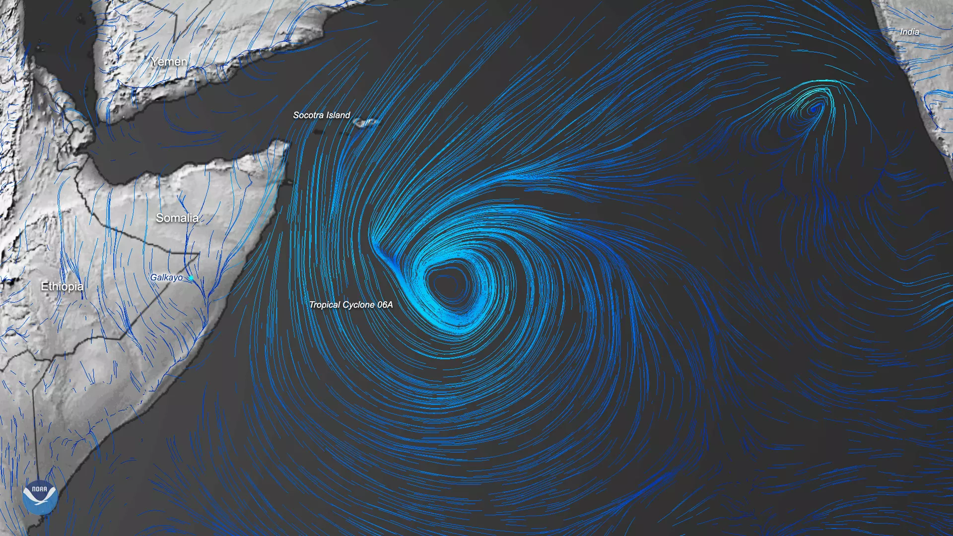
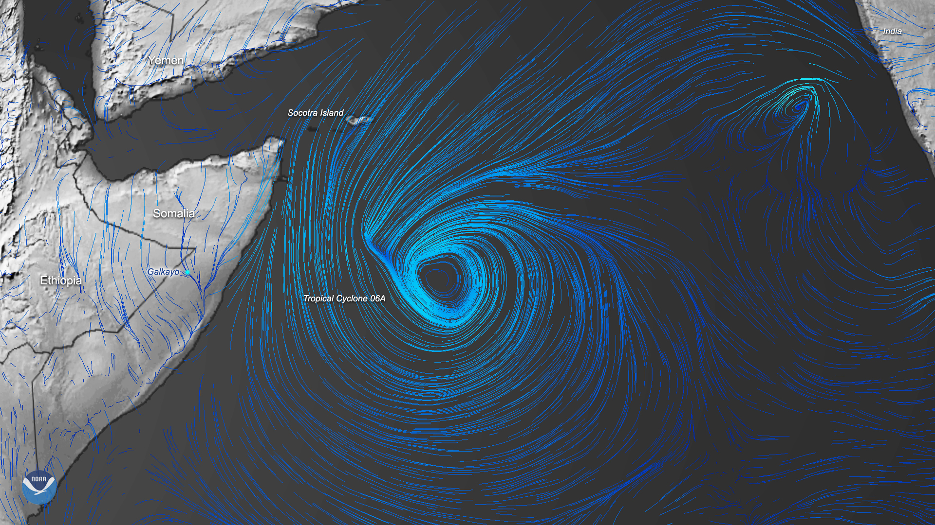
On Dec. 3, 2019, this image was created by using the Global Forecast System (GFS) data of Tropical Cyclone 06A off the coast of Somalia at 2:30 a.m. EST. As of 10 a.m. EST, the cyclone was swirling in the northwestern Indian Ocean with maximum sustained winds of 40 mph, according to The Joint Typhoon Warning Center (JTWC). Additionally, strong wind shear off of the Horn of Africa should prevent Tropical Cyclone 06A from intensifying much. On the immediate right of Tropical Cyclone 06A, Tropical Cyclone 07A is forming 367 nautical miles southwest of Mumbai off of the coastline of India. The maximum sustained winds for that system are expected to stay around 35 mph.
Tropical Cyclone 06A will continue to track southwestward before making landfall Thursday evening. Its winds are then expected to quickly diminish to less than 30 mph as it moves across the area immediately north of Somalia’s capital city, Mogadishu. According to the JTWC, the storms will dissipate around the city of Galkayo, with a forecast of heavy rain there by Friday morning. There will be some risk for flash flooding, but the most serious effects are expected to subside by Saturday evening.
The image above is a combination of the Global Winds data set from the Global Forecast System (GFS) model, taken from NOAA weatherView. It was visualized with the aid of graphic design programs and represented the two systems on the morning of Dec. 3, EST.