

Residents across the central and southern Plains are bracing for another round of severe weather as a potent spring storm system bears down on the region. Areas from northwest Texas into central and western Oklahoma are under a “high risk” for widespread severe storms, as well as, fast-moving, long-track tornadoes, according to NOAA’s Storm Prediction Center (SPC). This is the first “high risk” issued by the SPC since May 18, 2017.
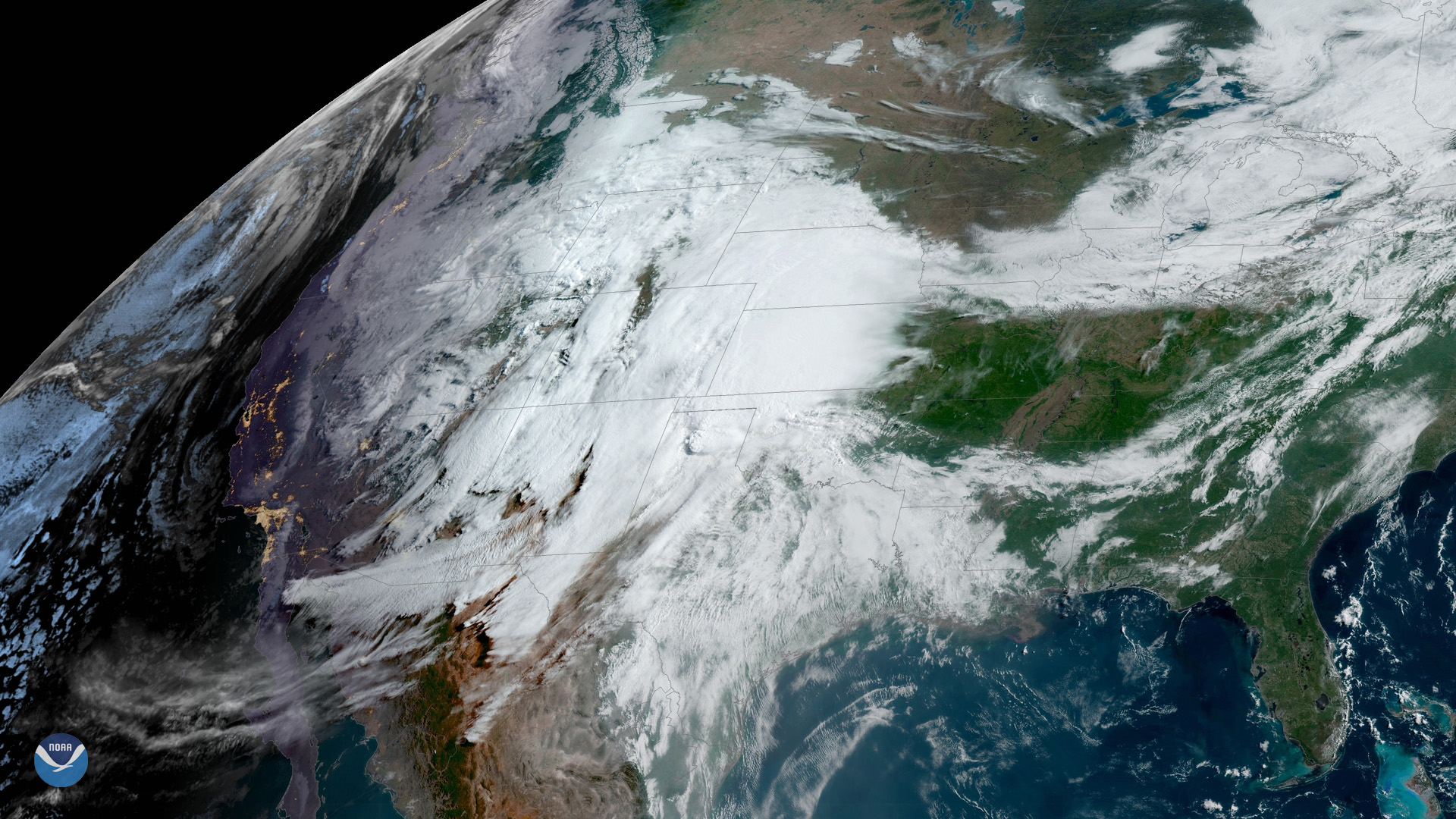
As GOES East watched the sunrise over the storm system on May 20, 2019, at 9:30 a.m. ET, heavy cloud cover and some convective activity were already visible over the Texas panhandle. The National Weather Service (NWS) pointed out on Twitter that the “low clouds streaming up from the SE [southeast] are being overtaken by mid-to-high clouds coming from the SW [southwest]. This turning of the winds helps storms that form start to rotate.”
Monday afternoon, the tornado risk is expected to rapidly increase across western Oklahoma and western north Texas before slowly diminishing overnight, according to the NWS. Large hail greater than 2 inches in diameter, damaging wind gusts of more than 75 mph and flash flooding are expected to accompany these severe storms.
This comes after a weekend of severe storms that prompted more than two dozen tornado reports across four states. People across Arkansas, Louisiana, Oklahoma and Texas reported uprooted trees, downed power lines and damaged homes.
As this severe weather pattern continues, residents across the Plains are encouraged to take immediate action if warnings are issued.