
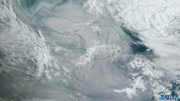
Better air quality forecasts are now a reality thanks to a new product called RAVE that has become operational in the U.S. Developed by a team of scientists from NOAA NESDIS and South Dakota State University, the Regional Hourly Advanced Baseline Imager (ABI) and Visible Infrared Imaging Radiometer Suite (VIIRS) Emissions (RAVE) product uses observations from NOAA’s geostationary and polar-orbiting weather satellites to better determine the impacts of wildfire smoke on air quality across the nation.
RAVE estimates wildfire emissions based on heat signatures, also known as fire radiative power, as seen from NOAA’s Earth-orbiting satellites. Unlike previous methods that used only the VIIRS instrument on NOAA’s Joint Polar Satellite System (JPSS) and the MODIS instrument on NASA’s Aqua and Terra satellites, RAVE incorporates data from the ABI instrument onboard NOAA’s GOES East and GOES West satellites, which provides more frequent updates for predicting how a wildfire is impacting air quality.
GOES satellites—which constantly observe specific areas of Earth as it rotates— provide RAVE with continuous observations of the same area and can more closely follow rapidly changing wildfires than the once-daily data from JPSS satellites. This combination allows RAVE to provide hourly rather than daily observations, which is particularly helpful when the size and intensity of wildfires are quickly fluctuating throughout the day.
Because of this, RAVE is now an integral part of the NOAA Office of Oceanic and Atmospheric Research’s High Resolution Rapid Refresh (HRRR) smoke model, and helps HRRR derive smoke emissions and perform smoke plume rise calculations.
What's more, the development of RAVE is especially important in an increasingly warming and drying climate, where fires are expected to intensify, noted Dr. Shobha Kondragunta, Air Quality Lead at the NESDIS Center for Satellite Research and Applications. “In just the last 10 years, smoke particles from fires in California, Washington, and Oregon alone increased by ~0.4 teragrams (roughly 441,000 tons) per year.”
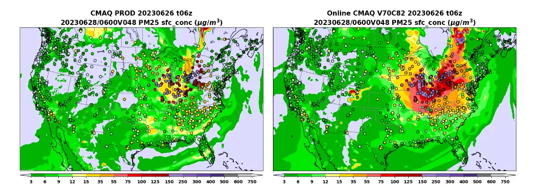
Early January 2024, RAVE will also be incorporated into NOAA’s Community Multiscale Forecasting Air Quality (CMAQ) model, which supports the National Air Quality Forecasting Capability by providing multi-day ozone and fine particulate pollution forecast guidance.
These efforts to deliver improved forecasts of wildfire smoke impacts on air quality stemmed from the Disaster Relief Act, a partnership between NOAA’s Office of Oceanic and Atmospheric Research, the National Weather Service and NESDIS. “Development of RAVE would not have been possible without the support of the Disaster Relief Support Act of FY2019 and FY2022," said NOAA NESDIS Wildland Fire Program Manager, Dr. Mike Pavolonis.