

On Monday, March 15, the Himawari-8 satellite, operated by our partner agency Japan Meteorological Agency, observed a massive dust storm sweep from the Gobi Desert in Mongolia across mainland China and surrounding countries. The resulting “Mars-like” orange-hued pall grounded more than 400 flights and closed schools in some areas.
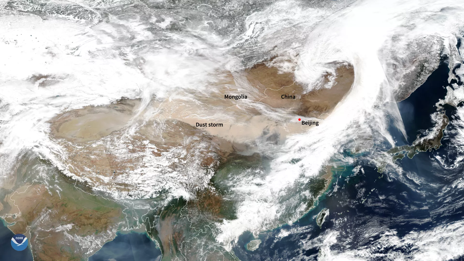
China and surrounding countries, March 15. NOAA-20 satellite imagery.
This phenomenon, which is colloquially known as “ yellow dust ”, happens periodically, affecting most of mainland Asia during the spring. According to meteorological experts in China, there are three different variables related to the ongoing event in the imagery: dust, blowing sands and dust storms. “Dust,” one meteorologist stated, “spreads over layers high in the atmosphere, while blowing sand from ground level winds creates dust storms. As the local surface wind increases, pollution on the ground blends with dust and sand, until muddy, low-visibility air leads to alerts.”
Moreover, the sandstorms have decreased in frequency and severity over time, thanks to ongoing reforestation efforts. However, authorities in Mongolia reported six deaths and dozens of people missing as a result of the continent-wide storm. Multiple meteorological experts are calling it the worst such sandstorm in a decade.
The tens of millions of people who were engulfed by the thick dust experienced poor visibility (below 500 meters in much of the region) and hazardous air quality. Moreover, the dust has lately been a carrier of industrial pollutants that have worsened the air quality for affected residents from as far away as South Korea, with authorities directing people to stay indoors when possible.
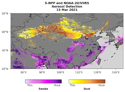
China and surrounding countries, March 15. Image courtesy of the Aerosol Watch team.
The types of imagery for this event reveal different features of the dust storm. What can be seen by the naked eye is very different from a more detailed analysis with the dust/smoke masks from Suomi-NPP’s Visible Infrared Imaging Radiometer Suite (VIIRS) instrument. In the 17-hour GeoColor time lapse Image of the Day, the sandstorm from China and Mongolia spread to the rest of Asia, with the color of the dust blending in with the land below. With the more colorful secondary image from March 15, the dust and smoke mask shows the air content and dust movement that were picked up by the Suomi-NPP’s VIIRS instrument. Since impurities such as dust are absorbing types of particles within air --- or aerosols---the dust storm shows up as a bright yellow color.