
A powerful late-season winter storm is set to unleash heavy snow and high winds across parts of the north-central Plains and the upper Midwest beginning Wednesday, April 10, 2019. Blizzard warnings are in effect for northeastern Colorado, southeastern Wyoming, western and central Nebraska, northwestern Kansas, southwestern Minnesota and nearly all of South Dakota.
The National Weather Service warns that both air and ground travel will become hazardous as visibilities could at times drop to near-zero. Widespread power outages are also likely, with 1 to 2 feet of snow possible for the central and northern Plains, as well as western Minnesota through Thursday evening.
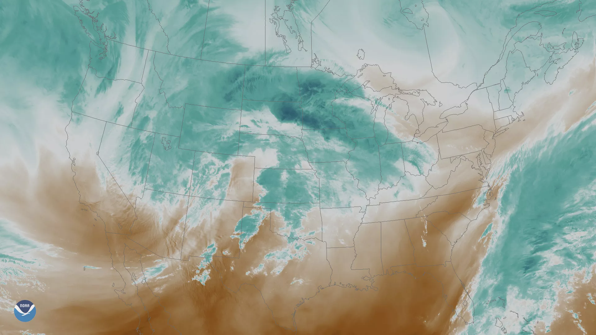
This water vapor imagery from the GOES East satellite is created using a wavelength sensitive to the moisture content in the atmosphere. In this imagery, bright blue and white areas indicate the presence of high water vapor or moisture content. Behind the winter storm, areas of dark orange and brown indicate the presence of little to no moisture. These very dry conditions combined with high winds could produce favorable conditions for rapid wildfire growth across the High Plains and Southwest.