
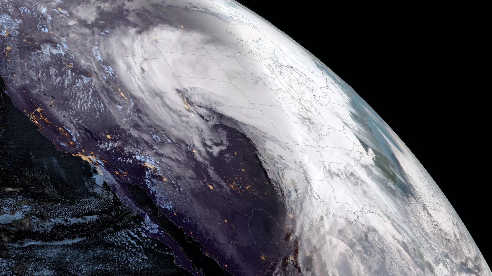
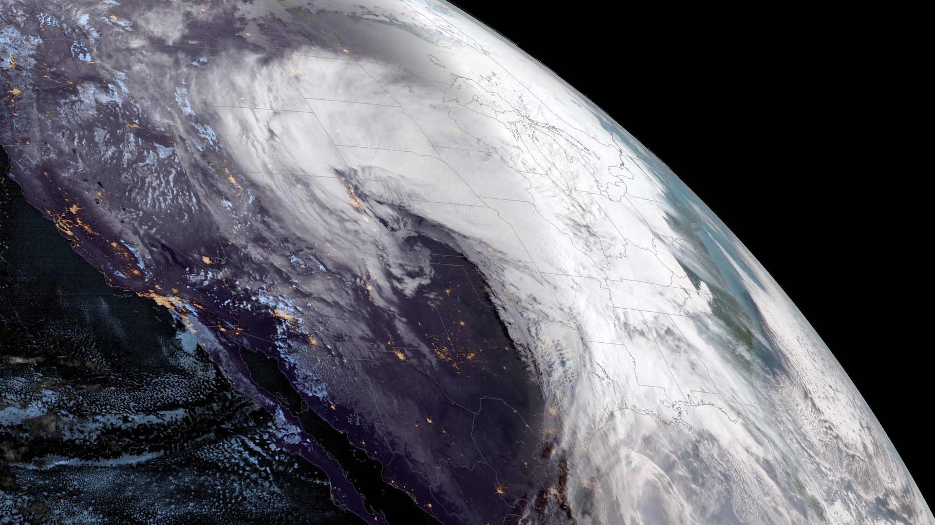
NOAA’s GOES West satellite captured this GeoColor limb view of the powerful winter storm system that’s expected to intensify Wednesday, March 13, 2019, before sweeping eastward across much of the Central U.S.
Blizzard warnings are already in effect from northeastern Colorado into southeastern Wyoming and across western Nebraska and southwestern South Dakota, according to the National Weather Service Weather Prediction Center (WPC). Heavy rains, severe thunderstorms, isolated flooding, heavy snow and blizzard conditions associated with this storm could lead to “extremely dangerous†travel conditions. In the areas mentioned above, the WPC warns that visibility will drop to near zero during the height of the storm.
“You risk becoming stranded if you attempt to travel through these conditions,†the WPC tweeted.
As of 11:16 a.m. 1,417 flights within, into or out of the United States were canceled, according to FlightAware.com. Denver International Airport and Dallas-Fort Worth International Airport were among the airports most affected by the impending storm with more than 1,000 and nearly 140 cancellations respectively.
Parts of the southern and central High Plains, which are on the southern side of this storm, are expected to experience very high winds with sustained speeds of up to 30-40 mph and gusts of over 60 mph.
This GeoColor enhanced imagery was created by NOAA's partners at the Cooperative Institute for Research in the Atmosphere. The GOES West satellite, also known as GOES-17, provides geostationary satellite coverage of the Western Hemisphere, including the United States, the Pacific Ocean, Alaska and Hawaii. First launched in March 2018, the satellite became fully operational in February 2019.