
A highly sophisticated sensor onboard the Suomi NPP satellite detected a thermal anomaly, which indicated increased volcanic activity at Mount Sakurajima, 14 hours before an eruption on August 18.
The sensor, called the Visible Infrared Imaging Radiometer Suite, or VIIRS, is a new instrument flying on Suomi NPP, which is the first of three next-generation satellites of NOAA’s Joint Polar Satellite System (JPSS). VIIRS is able to scan the land, oceans and atmosphere to more accurately capture data – even at night, using a "day-night band" channel. As Suomi NPP orbits the globe near the poles 14 times each day, it is able to monitor for new thermal global sources, such as gas flaring, and pinpoint new sources of heat, such as the Sakurajima volcano.
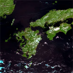
The dramatic eruption of Mount Sakurajima sent up a thick ash plume three miles into the air, according to the Kagoshima Local Meteorological Observatory in Japan.
“VIIRS continues to show new and remarkable capabilities that will enable scientists to better understand the Earth – from the land to the highest levels of the atmosphere,” said Dr. Chris Elvidge, head of the Earth Observation Group of NOAA’s National Geophysical Data Center in Boulder, CO.
VIIRS will fly on the second JPSS spacecraft – JPSS-1, which is set to launch in 2017 and JPSS-2 in 2021. JPSS represents significant technological and scientific advances for more accurate weather forecasting to secure a more 'weather ready nation' -- saving more lives and property, while promoting economic prosperity. JPSS provides continuity of critical Earth and environmental observations of our vast atmosphere, oceans, land, and cryosphere.
NOAA is working in partnership with NASA to develop JPSS, which ensures an unbroken series of global data for monitoring and forecasting environmental phenomena and understanding our Earth. Suomi NPP also is a NOAA-NASA partnership.
NOAA’s mission is to understand and predict changes in the Earth's environment, from the depths of the ocean to the surface of the sun, and to conserve and manage our coastal and marine resources. Join us on Facebook, Twitter and our other social media channels.