When the topic du jour turns to satellite meteorology and its benefits, the spacecraft usually get all the attention. This stands to reason, but there is no denying that satellites are only half of the highly specialized technical apparatus that collects remotely sensed data and makes it available to scientists. The other, less talked-about half of this system is commonly referred to as the “ground system.”

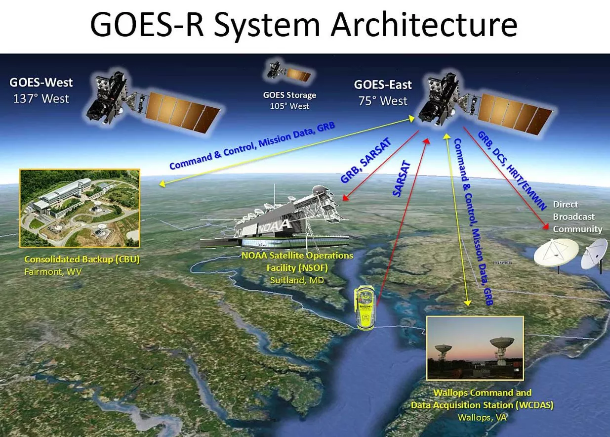
For GOES-16, NOAA's revolutionary new geostationary weather satellite launched November 19, 2016, the agency developed a state-of-the-art ground system that includes components for data processing, satellite monitoring and operations, and a new antenna system for space-to-ground communications.
The core of this new ground system consists of facilities at two primary locations: the NOAA Satellite Operations Facility (NSOF) in Suitland, Maryland, and the Wallops Command and Data Acquisition Station (WCDAS) in Wallops, Virginia. A third operations facility in Fairmont, West Virginia, serves as what’s known as a Consolidated Backup (CBU).
The most visible, and perhaps most intriguing, components of the ground systems at these locations are the skyward-facing antennas, each of which has been designed and constructed to work with all of NOAA’s current geostationary satellites (GOES-13, -14 and -15) and the spacecraft of the GOES-R series (GOES-R/16, -S, -T and -U).
Antenna Specifics
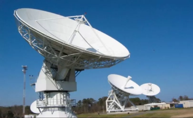
The antennas at NSOF, WCDAS and BU are either 9.1-meter or 16.4-meter parabolic dish antennas (the numbers in their names refer to their dish size). The dishes on these antennas are required to enhance capture of the low-level radio frequency (RF) signals GOES satellites transmit to earth from their geostationary orbit 22,236 miles above the surface.

As these antennas are often placed in the open and thus exposed to the elements, they are "hurricane" rated, which means they are designed to withstand the sustained winds of a Category 2 storm (110 miles per hour). In their "stowed" position, these antennas can withstand the 150 miles per hour winds of a Category 4 hurricane. Aside from the high winds associated with severe storms, the other main physical threat to ground system antennas is flying debris.
RF signal interference, which comes primarily from other RF transmitters/sources using frequencies on or closely adjacent to those assigned to satellite transmissions, is another concern. Access to the RF spectrum is vital to NOAA’s mission, as every NOAA satellite in orbit uses some portion of the RF spectrum to communicate with a ground system or other satellites. As the commercial demand for spectrum grows, frequencies currently used for satellite transmission are being proposed for reallocation to companies and other private entities. This can lead to serious problems when more powerful signals from commercial satellites interfere with the less powerful meteorological satellite signals. When this happens, it becomes very difficult to receive a complete satellite signal, risking the loss of crucial satellite data. (To learn more about such interference, see “NOAA’s Environmental Observations: Spectrum Matters.”)
Supporting the GOES-16 Mission and More
The ground system receives the raw data from GOES-R series spacecraft, generates real-time data products and makes these products available to users in a timely manner consistent with the GOES-16 series latency requirements (i.e., the period of time that data is held before it is forwarded to users.)
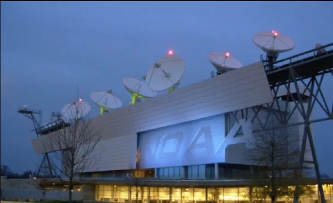
At NSOF, which houses the majority of GOES-R/16 mission operations and science data production, four 9.1-meter antennas were upgraded to be compatible with GOES-16's systems. These upgraded, reception-only antennas remain compatible with the existing GOES satellites and will operate continuously for the life of GOES-R series satellites.

At WCDAS, which serves as the primary site for space-to-ground communications in the GOES-R era, three new 16.4-meter antennas were installed. These new antennas facilitate up-link to the in-orbit satellites. The antennas also support the unique payload services, which consist of transponders providing communications relay services for a number of auxiliary services. These auxiliary services are provided simultaneously with the ground system’s primary function, which is to receive GOES mission data.Three new 16.4-meter antennas were also constructed at the CBU and will be used as a back-up in the event of a problem at the other facilities. These new antennas, which can perform all of the critical functions of those at NSOF and WCDAS, are compatible with existing GOES satellites as well.
Prepared for Emergencies
Given that NOAA's satellites provide critical information during a national emergency, such contingency planning is a necessity, and, according to Charles Bryant, acting station manager at WCDAS, part of the reason WCDAS and CBU are located in different areas of the country.
"A study was conducted to look at sites [for these stations] across the continental United States," he said. "The final locations for WCDAS and CBU were selected based on the availability of existing infrastructure, geographical separation, and accessibility during a COOP (or Continuity of Operations Plan) event, such that a single event would have a low probability of impacting both sites."
To learn more about the GOES-R satellite series ground system, visit the GOES-R website.
