
Atmospheric Rivers are a primary feature in the entire global water cycle, and are tied closely to both water supply and flood risks, particularly in the western United States.
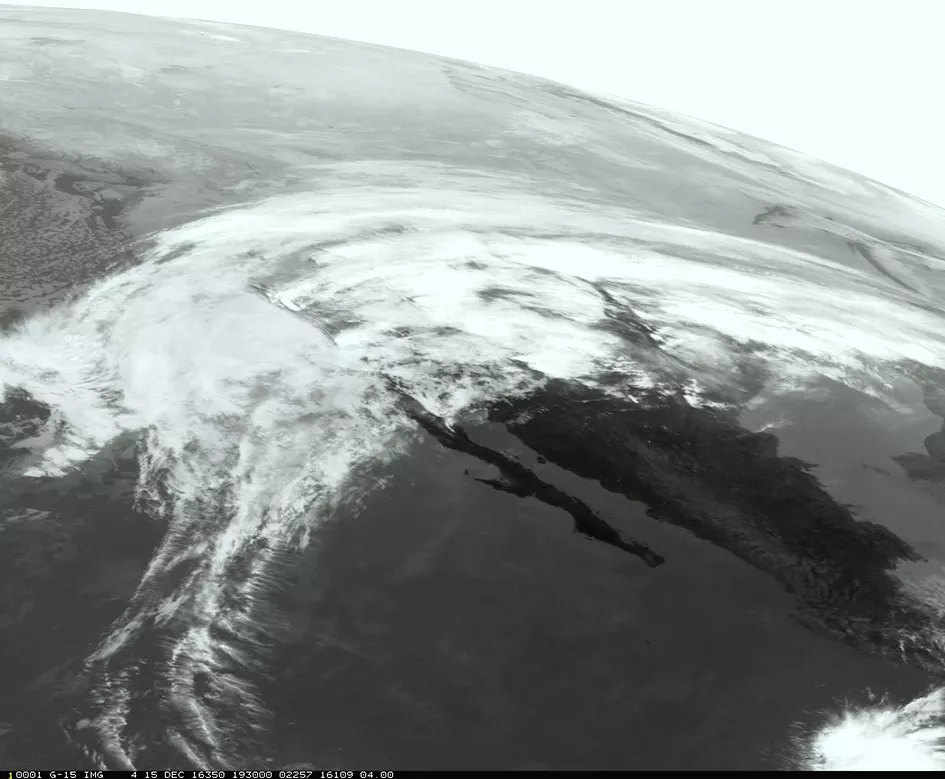
This infrared image from GOES-West offers a nice perspective on the atmospheric river responsible for bringing precipitation to the western United States today, December 15, 2016.
Atmospheric rivers are relatively narrow regions in the atmosphere that are responsible for transporting much of the moisture from the tropics northward. They are formed when winds over the ocean force atmospheric water vapor into bands. These so-called "rivers" then travel across the Pacific from the tropics and are sometimes directed toward land.
Atmospheric rivers come in all shapes and sizes, but those that contain the largest amounts of water vapor and the strongest winds are responsible for extreme rainfall events and floods. These events can affect the entire west coast of North America, often disrupting travel and damaging property in the process. Of course, not all atmospheric rivers are disruptive. Many are weak and provide beneficial rain or high elevation snow that provides crucial inputs to the water supplies of western communities.
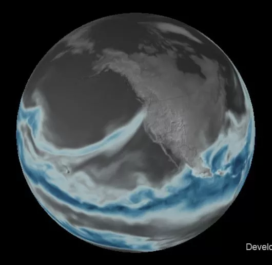
This image from NOAA's WeatherView shows the "atmospheric river" that the National Weather Service expects to bring rain and high elevation snow to the Pacific Northwest today, November 14, 2016.
To see more GOES West imagery, visit the GOES West Satellite Imagery Footprint page
on the NOAA website.
For more information on atmospheric rivers, see the following documents: