
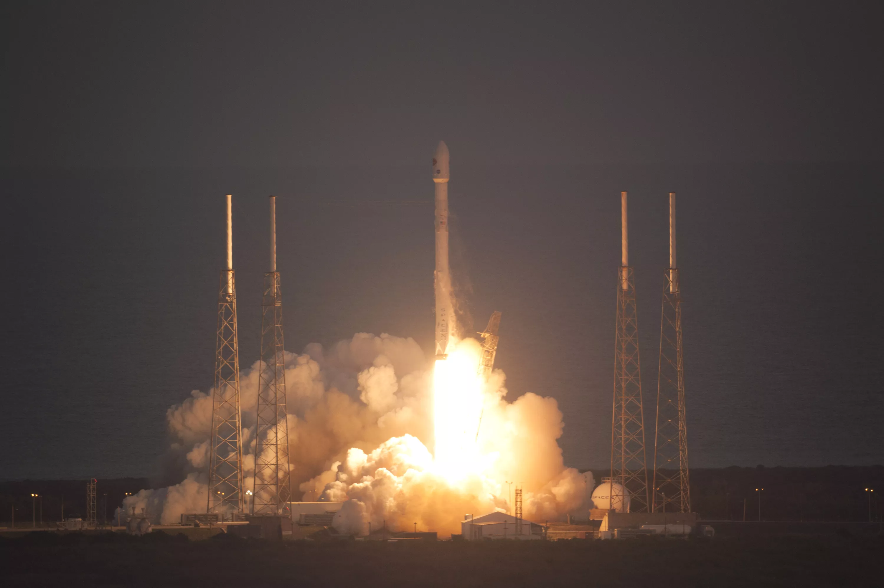
DSCOVR successfully launched on February 11, 2015 from Cape Canaveral, Florida. It took the satellite just over 100 days to reach its final orbit at Lagrange point 1. Credit NOAA
Earlier today, NOAA officially took command of its Deep Space Climate Observatory (DSCOVR) satellite.
NASA, in charge of both the launch and activation of the satellite, has officially handed over satellite operations to NOAA’s DSCOVR team. Next, the team will optimize the final space weather instrument settings and the satellite will soon begin normal operation.
Launched February 11, 2015, DSCOVR – the nation’s first operational satellite in deep space – is set to replace NASA’s 17-year old ACE research satellite as America’s primary warning system for solar magnetic storms and solar wind data. (ACE will continue its role in space weather research).
DSCOVR will give NOAA’s Space Weather Prediction Center (SWPC) forecasters higher-quality measurements of solar wind conditions, improving their ability to monitor and warn of severe and potentially dangerous space weather events.
Like a sensor buoy at sea can warn us of on oncoming tsunami, DSCOVR will be able to provide warnings 15 to 60 minutes before solar storms reach Earth.
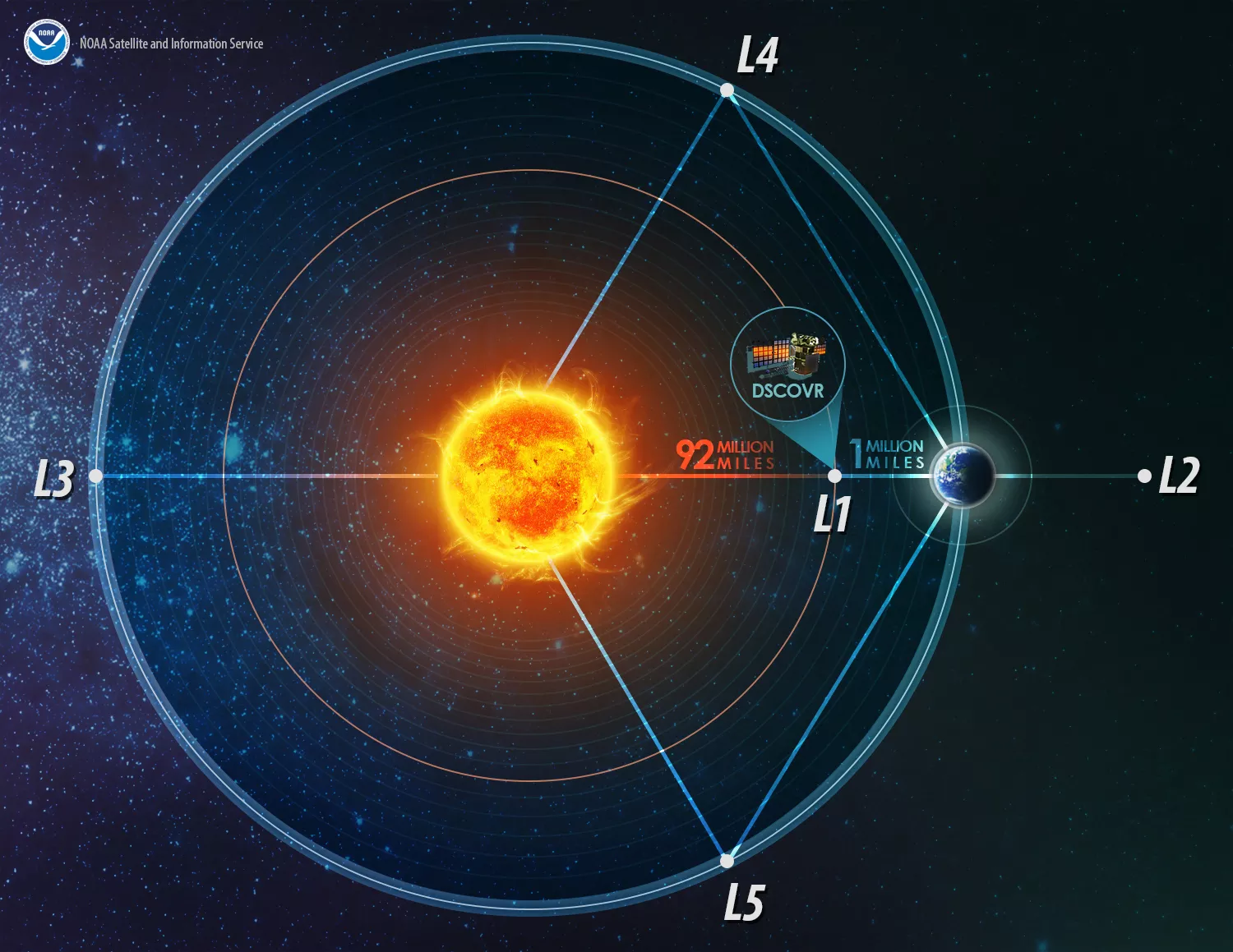
America’s first operational deep space satellite orbits one million miles from Earth. Positioned between the sun and Earth, it is able to maintain a constant view of the sun and sun-lit side of Earth. This location is called Lagrange point 1. (Illustration is not to scale) Credit: NOAA
A million miles away, DSCOVR orbits a unique location called Lagrange point 1, or L1. This point is a gravity neutral point in space, allowing DSCOVR to essentially hover between the sun and Earth at all times.
DSCOVR will be our eyes on the sun, and give us early warning when it detects a surge of energy that could trigger a geomagnetic storm destined for Earth,†said Stephen Volz, Ph.D., assistant administrator for NOAA’s Satellite and Information Service.
Early warnings are crucial because solar storms have the potential to produce major disruptions to our infrastructure here on Earth.
The most severe solar storms start with a huge magnetic eruption on the Sun that is first seen as a solar flare. X-rays produced in the flare inflame the Earth’s ionosphere and can disrupt high-frequency radio communications like those used in commercial aviation to communicate with aircraft. The eruption can also cause a “coronal mass ejection,†sending enormous clouds of magnetic plasma that can cause strong electrical currents in the ionosphere and inside the Earth, disrupting electrical power grids, corroding gas and oil pipelines, and impeding the use of the Global Positioning System (GPS) by search-and-rescue crews.
In 2013, a Lloyds of London study predicted that the most extreme space weather storms could affect 20 to 40 million people in the U.S. and cause up to $2.6 trillion in damages, with recovery taking up to two years.
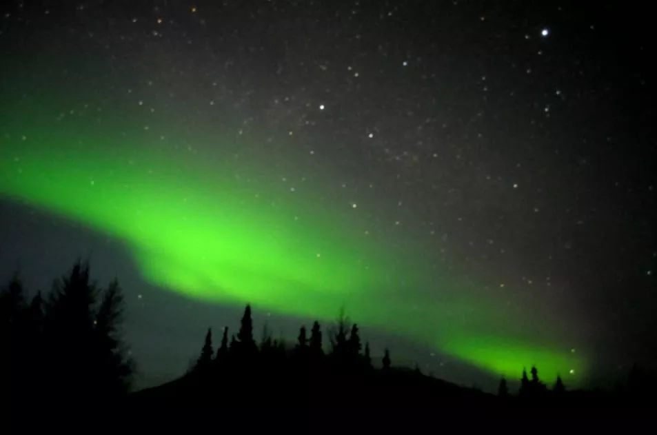
An aurora as seen over the Poker Flat Research Range north of Fairbanks, Alaska, on February 28, 2011. An aurora is caused when charged particles from the Sun, mainly electrons and protons, interact with the upper atmosphere. Credit: NOAA
Outside of our atmosphere, these solar storms can harm astronauts and the equipment they rely on to survive. In fact, in 1972 a solar flare came within months of disrupting the last two Apollo missions to the moon!
In addition to its space weather instrument suite, DSCOVR is flying two NASA Earth-observing instruments, known as NISTAR and EPIC, which will gather a range of measurements, from ozone and aerosol amounts to changes in Earth's radiation. Daily views of Earth from NASA’s EPIC can be seen at http://epic.gsfc.nasa.gov.
DSCOVR is a partnership between NOAA, NASA and the U.S. Air Force. NOAA is operating DSCOVR from its NOAA Satellite Operations Facility in Suitland, Maryland, and will process the space weather data at SWPC in Boulder, Colorado. From there, the SWPC will distribute the DSCOVR data to users within the United States and around the world. The data will be archived at NOAA’s National Geophysical Data Center, also in Boulder.
NOAA funded NASA to refurbish the DSCOVR satellite and its solar wind instruments, develop the command and control portion of the ground segment, and manage the launch and activation of the satellite. The Air Force funded and managed the Falcon 9 launch services for DSCOVR. Data from the NASA-funded secondary sensors for Earth and space science observations will be processed at NASA’s DSCOVR Science Operations Center and archived and distributed by NASA’s Atmospheric Science Data Center.
Looking for more on space weather and solar observations? Check out the following links!