
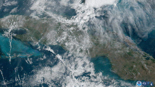
On April 26, 2020, the GOES-East satellite captured explosive yet beautiful thunderstorms unfolding across Cuba.
This regularly occurs over the Caribbean island because the sun heats up land faster than water, which causes it to become warmer than the surrounding ocean. Via the process of convection, the warmer, less dense air over the island rises while the cooler air over the water sinks. This forms a cycle of moving air where the cooler, high pressure air mass pushes toward the warmer area of lower pressure.
The sharp boundary between the two air masses is called a sea breeze front. Similar to a cold front , the air temperature drops significantly and the skies clear once the front passes. Here, as opposing sea breezes converge over land, we can see a line of cumulus clouds forming along the length of the island. Like with cold fronts, thunderstorms can often develop as the cooler sea breeze air helps push the warmer, unstable air over the island upward.
The GOES-East geostationary satellite, also known as GOES-16, keeps watch over most of North America, including the continental United States and Mexico, as well as Central and South America, the Caribbean, and the Atlantic Ocean to the west coast of Africa. The satellite's high-resolution imagery provides optimal viewing of severe weather events, including thunderstorms, tropical storms, and hurricanes.