
The high-resolution offered by GOES-16's Advanced Baseline Imager will allow forecasters to see meteorological phenomena in vivid detail.
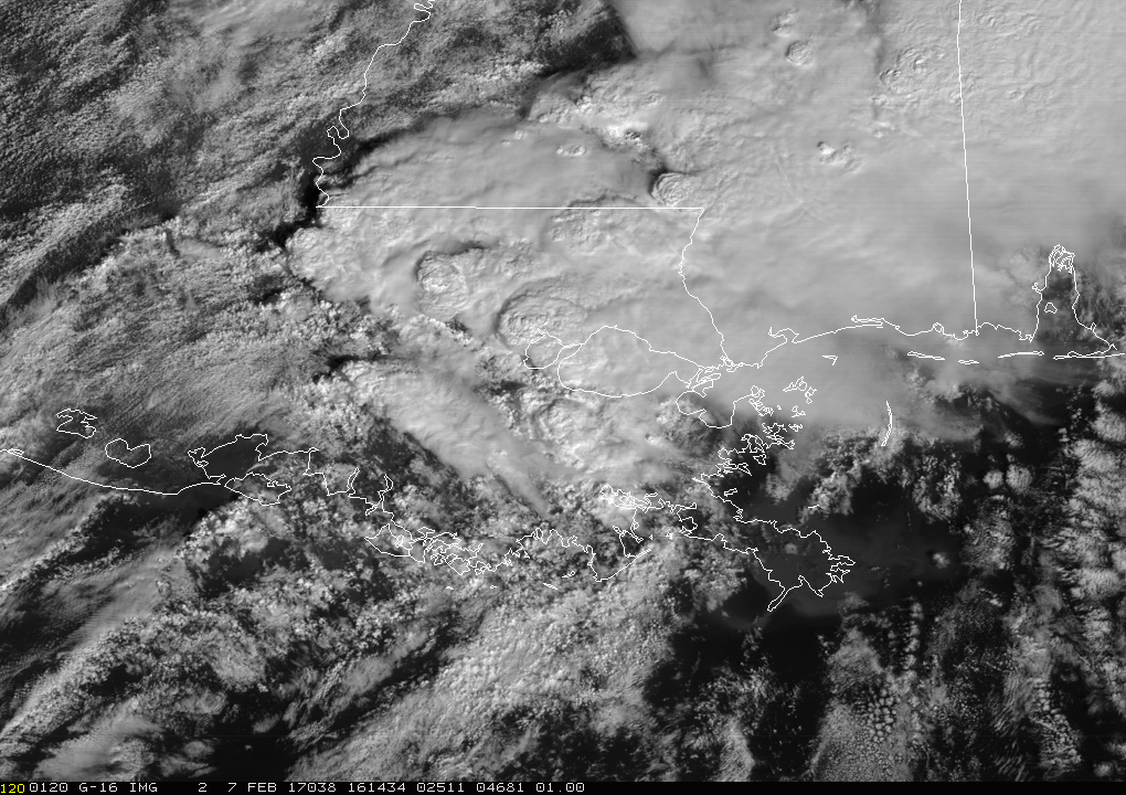
This visible animation from GOES-16 shows the tornadic storms that swept through Louisiana yesterday, February 7, 2017. According to several news outlets, Louisiana remains in a state of emergency after the storms destroyed homes and businesses, disrupted power, and injured dozens of people in the southeastern part of the state.
As this imagery illustrates, the high-resolution offered by GOES-16's Advanced Baseline Imager will allow meteorologists to see meteorological phenomena in vivid detail. For example, in this loop, note how the top of the tornadic storm can be seen passing along the southern coast of Lake Pontchartrain.
ABI is a multi-channel passive imaging radiometer designed to observe the Western Hemisphere and provide variable area imagery and radiometric information of Earth’s surface, atmosphere and cloud cover. ABI will be used for a wide range of applications related to weather, oceans, land, climate, and hazards. The instrument has two scan modes. The default mode will concurrently take a full disk (Western Hemisphere) image every 15 minutes, an image of the Continental U.S. every five minutes, and two smaller, more detailed images of areas where storm activity is present, every 60 seconds.
Additional imagery from GOES-16 is available on the NESDIS website.
To learn more about the ABI, visit the GOES-R.gov website.
Note: As GOES-16 continues to undergo tests, these data are experimental and should not be used operationally.