
This data visualization shows the forecast minimum surface temperatures across the western hemisphere at 4:00 am EST on December 15, 2016.
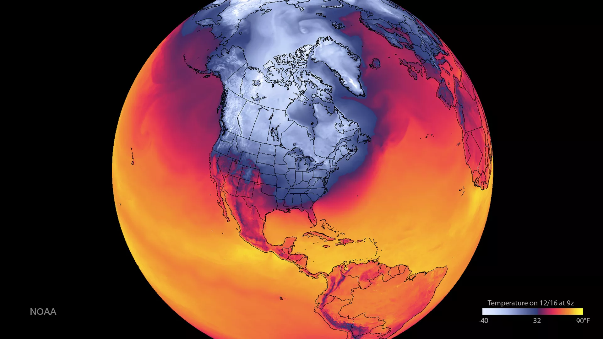
This visualization shows predicted air temperature (at 2 meters) across the entire United States. A distinct transition at the freezing point (32 degrees F and 0 degrees C) and below are represented by blue to white colors, and warmer temperatures are represented from red to yellow. The very cold air across Canada is forecast to spread south and reinforce the bitter cold over midsections of the U.S. by this weekend. Along the Canadian border, from North Dakota to Minnesota, temperatures may remain below 0 Fahrenheit through the weekend. This graphic was created with data from the Global Forecast System mathematical model, which is used by the National Weather Service to produce forecasts up to 16 days in advance. However, like any prediction model, the forecast accuracy decreases significantly the farther out the prediction period is. The GFS is produced by NOAA's National Centers for Environmental Prediction and contains dozens of atmospheric and land-soil variables ranging from temperatures, winds, and precipitation to soil moisture and atmospheric ozone concentration.