
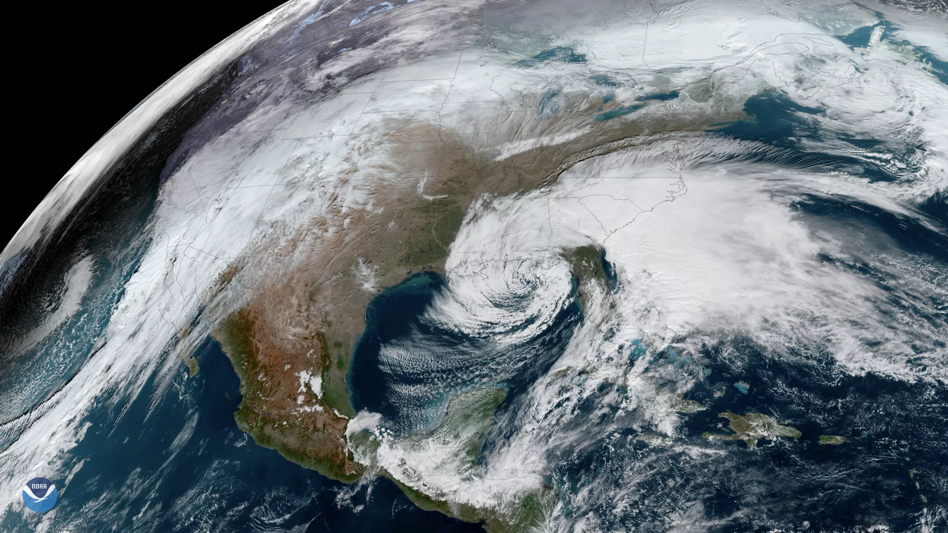
For the holidays, a low pressure system in the Southeast provides an interesting contrast to more wintery weather in the West in this GeoColor GOES East image from 1620 UTC, or 11:20 a.m. EST.
A flash flood watch will remain in effect through Tuesday morning for parts of the Carolinas and impact major thoroughfares, where “a strong storm system will produce another 3 to 5 inches of rain...highest near and east of Interstate-95.” The bulletin adds, “elevated tides [along the coast] could increase the potential for flash flooding,” particularly around the time of high tides on Monday. Ultimately, people should be prepared to “protect life and property, especially in areas prone to flooding... [and when necessary,] move to higher ground immediately.”
For the West, the winter weather advisory remains in effect from 12 p.m. MST Tuesday to 6 p.m. on Christmas Day; forecasters expect snow accumulations of 7 to 14 inches in the San Juan Mountains in Colorado and 2 to 6 inches in and around San Diego, California. The National Weather Service said that travelers in that region should expect “snow-covered roads and limited visibility, and [to] use caution while driving.”
The GOES East geostationary satellite, also known as GOES-16, keeps watch over most of North America, including the continental United States and Mexico, as well as Central and South America, the Caribbean, and the Atlantic Ocean to the west coast of Africa. The satellite's high-resolution imagery provides optimal viewing of severe weather events, including thunderstorms, tropical storms, and hurricanes.